Approximate Location Map
Large Map »
Latitude: 52.9243 / 52°55'27"N
Longitude: -1.4876 / 1°29'15"W
OS Eastings: 434544
OS Northings: 336445
OS Grid: SK345364
Mapcode National: GBR PHF.02
Mapcode Global: WHDGT.3RWJ
Plus Code: 9C4WWGF6+PX
Entry Name: 83-84, Friar Gate
Listing Date: 20 June 1952
Grade: II
Source: Historic England
Source ID: 1287559
English Heritage Legacy ID: 402027
ID on this website: 101287559
Location: Derby, Derbyshire, DE1
County: City of Derby
Electoral Ward/Division: Mackworth
Parish: Non Civil Parish
Built-Up Area: Derby
Traditional County: Derbyshire
Lieutenancy Area (Ceremonial County): Derbyshire
Church of England Parish: Derby St John the Evangelist
Church of England Diocese: Derby
Tagged with: Building
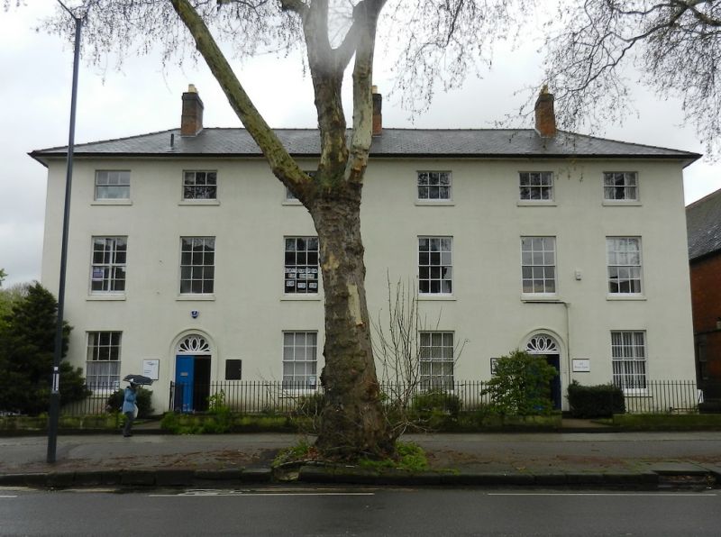
FRIAR GATE
1.
5170
(South Side)
SK 3436 4/128 20.6.52. Nos 83 and 84
II GV
2.
Early or mid C19. Stucco; 5 storeys; 6 sash windows; 2 doorways in moulded stucco
surrounds with semi-circular heads and traceried fanlights; bold eaves cornice;
slates.
Nos 78 to 84 (consec) form a group.
Listing NGR: SK3454436445
External links are from the relevant listing authority and, where applicable, Wikidata. Wikidata IDs may be related buildings as well as this specific building. If you want to add or update a link, you will need to do so by editing the Wikidata entry.


Other nearby listed buildings
