Approximate Location Map
Large Map »
Latitude: 50.7658 / 50°45'56"N
Longitude: -3.2751 / 3°16'30"W
OS Eastings: 310170
OS Northings: 97020
OS Grid: SY101970
Mapcode National: GBR P7.L354
Mapcode Global: FRA 4702.5VT
Plus Code: 9C2RQP8F+8X
Entry Name: Gosford Bridge
Listing Date: 11 January 1974
Grade: II
Source: Historic England
Source ID: 1289178
English Heritage Legacy ID: 397756
ID on this website: 101289178
Location: Gosford, East Devon, EX11
County: Devon
District: East Devon
Civil Parish: Ottery St. Mary
Traditional County: Devon
Lieutenancy Area (Ceremonial County): Devon
Church of England Parish: Ottery St Mary
Church of England Diocese: Exeter
Tagged with: Bridge
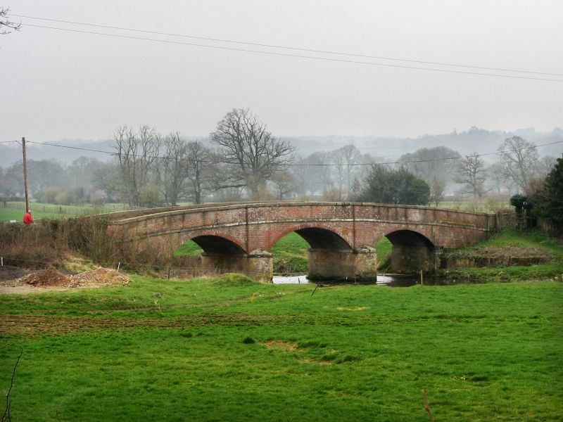
GOSFORD
1. -------
1481
Gosford Bridge
SY 19 NW 4/65
II
2
Rebuilt after the old bridge was washed away on October 4th 1824. Present
one is very like Cadhay Bridge, (qv). 3 segmental arches. Parapet and arches
are of brick. Parapet has stone coping and band at road level. Between the
arches are low rounded stone cut-waters with pilasters above them up to the
top of the parapet. NMR.
Listing NGR: SY1017097020
External links are from the relevant listing authority and, where applicable, Wikidata. Wikidata IDs may be related buildings as well as this specific building. If you want to add or update a link, you will need to do so by editing the Wikidata entry.


Other nearby listed buildings
