Approximate Location Map
Large Map »
Latitude: 51.4282 / 51°25'41"N
Longitude: -1.5218 / 1°31'18"W
OS Eastings: 433340
OS Northings: 170024
OS Grid: SU333700
Mapcode National: GBR 700.D28
Mapcode Global: VHC1S.KCTG
Plus Code: 9C3WCFHH+77
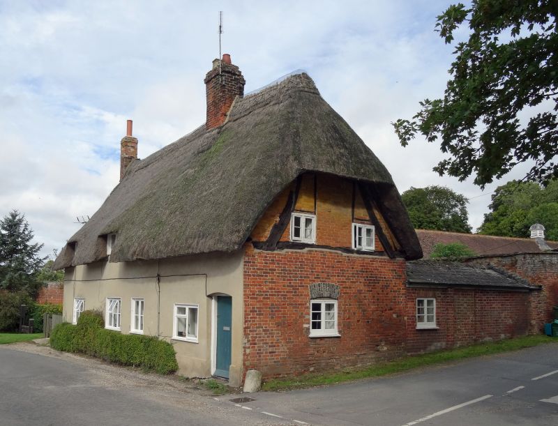
Entry Name: The Bothy
Listing Date: 8 June 1984
Grade: II
Source: Historic England
Source ID: 1289725
English Heritage Legacy ID: 396562
ID on this website: 101289725
Location: Leverton, West Berkshire, RG17
County: West Berkshire
Civil Parish: Hungerford
Traditional County: Berkshire
Lieutenancy Area (Ceremonial County): Berkshire
Tagged with: Architectural structure Thatched cottage
HUNGERFORD LEVERTON
SU 37 SW
9/18 The Bothy
II
Pair of cottages. C17 with C19 facing. Thatched roof, half hip to
East gable and end chimney to West, main chimney off centre to right.
Brick end walls with cruck-like timber frame exposed in East gable,
rendered front. 1½ storeys. 2 eaves dormers cut into thatch to left,
4 casement windows and plain boarded door to right. Thatched, gabled
porch on West elevation.
Listing NGR: SU3334070023
External links are from the relevant listing authority and, where applicable, Wikidata. Wikidata IDs may be related buildings as well as this specific building. If you want to add or update a link, you will need to do so by editing the Wikidata entry.


Other nearby listed buildings
