Approximate Location Map
Large Map »
Latitude: 52.1839 / 52°11'2"N
Longitude: -0.1425 / 0°8'32"W
OS Eastings: 527091
OS Northings: 255590
OS Grid: TL270555
Mapcode National: GBR J4P.0SD
Mapcode Global: VHGMP.HC1N
Plus Code: 9C4X5VM5+H2
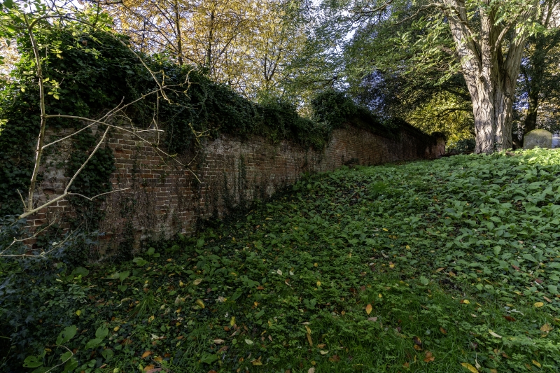
Entry Name: Boundary Wall to North of Rectory Farmhouse
Listing Date: 18 November 1983
Grade: II
Source: Historic England
Source ID: 1290190
English Heritage Legacy ID: 395645
ID on this website: 101290190
Location: Great Gransden, Huntingdonshire, Cambridgeshire, SG19
County: Cambridgeshire
District: Huntingdonshire
Civil Parish: Great Gransden
Built-Up Area: Great Gransden
Traditional County: Huntingdonshire
Lieutenancy Area (Ceremonial County): Cambridgeshire
Church of England Parish: Great Gransden St Bartholomew
Church of England Diocese: Ely
Tagged with: Wall
TL 26556 Tl2755 GREAT GRANSDEN CHURCH STREET
(South Side)
14/30A 15/30A Boundary wall
to north of
Rectory Farmhouse
II
C18 boundary wall, red brick.
Listing NGR: TL2709155590
External links are from the relevant listing authority and, where applicable, Wikidata. Wikidata IDs may be related buildings as well as this specific building. If you want to add or update a link, you will need to do so by editing the Wikidata entry.


Other nearby listed buildings
