Approximate Location Map
Large Map »
Latitude: 51.4892 / 51°29'21"N
Longitude: -0.6091 / 0°36'32"W
OS Eastings: 496668
OS Northings: 177608
OS Grid: SU966776
Mapcode National: GBR F8D.NT7
Mapcode Global: VHFT8.DTCS
Plus Code: 9C3XF9QR+M9
Entry Name: 18, High Street
Listing Date: 30 September 1969
Grade: II
Source: Historic England
Source ID: 1290215
English Heritage Legacy ID: 395599
ID on this website: 101290215
Location: Eton, Windsor and Maidenhead, Berkshire, SL4
County: Windsor and Maidenhead
Civil Parish: Eton
Built-Up Area: Eton
Traditional County: Buckinghamshire
Lieutenancy Area (Ceremonial County): Berkshire
Church of England Parish: Eton
Church of England Diocese: Oxford
Tagged with: Building
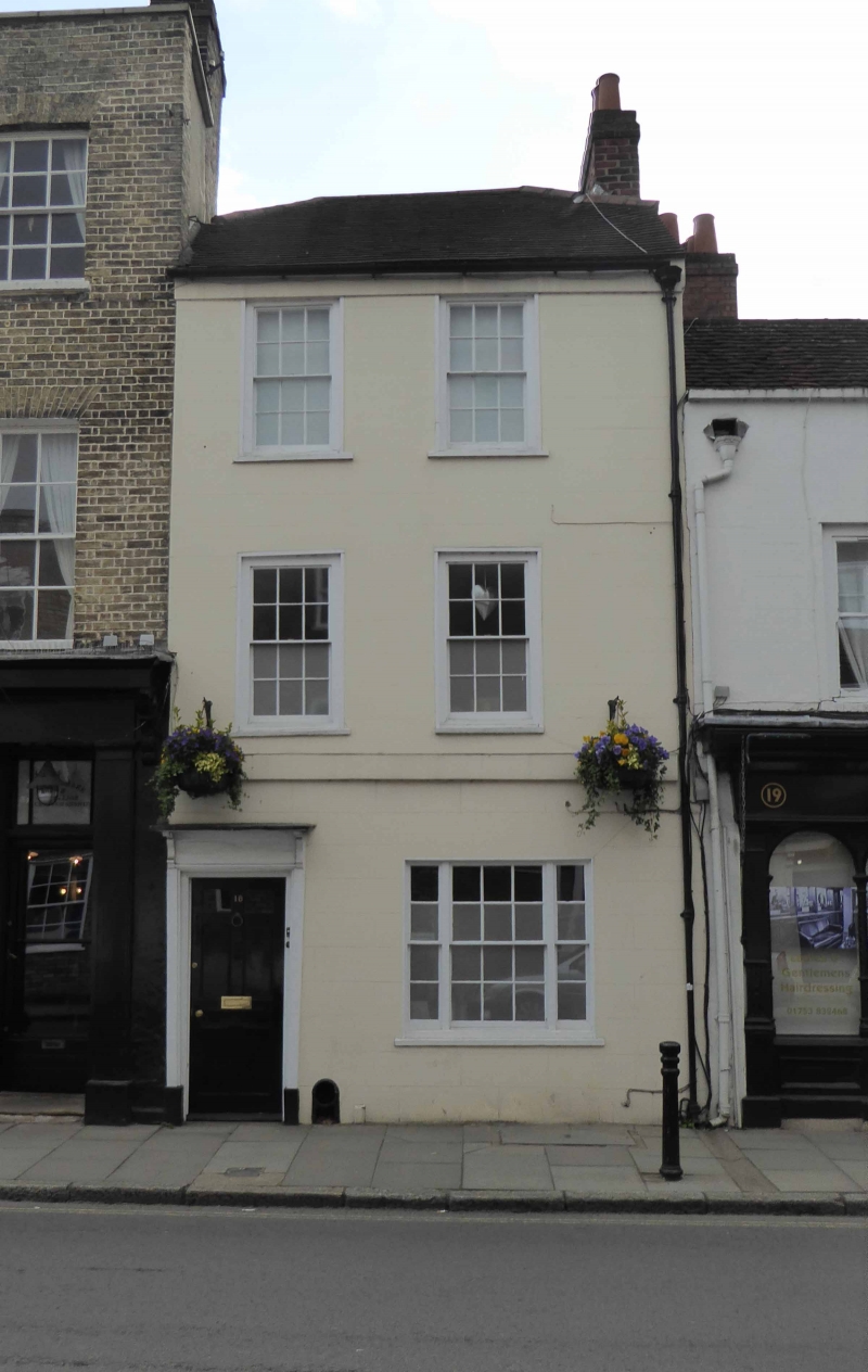
1. HIGH STREET
1909 (East side)
No 18
SU 9677 NE 1/13 30.9.69.
II GV
2.
C18. Stucco. 3 storeys, 2 double-hung sashes in surrounds with sills ; ground
floor 3-light window with wood mullions, 1st floor windows without glazing bars.
First floor band. Tiled roof. Doorway: bracketed hood, 4-flush panel door, 2
panels replaced by glass.
Nos 17 to 33 (consec) form a group.
Listing NGR: SU9666877608
External links are from the relevant listing authority and, where applicable, Wikidata. Wikidata IDs may be related buildings as well as this specific building. If you want to add or update a link, you will need to do so by editing the Wikidata entry.


Other nearby listed buildings
