Approximate Location Map
Large Map »
Latitude: 53.6924 / 53°41'32"N
Longitude: -1.7597 / 1°45'34"W
OS Eastings: 415963
OS Northings: 421796
OS Grid: SE159217
Mapcode National: GBR JT4R.T3
Mapcode Global: WHC9V.YG66
Plus Code: 9C5WM6RR+X4
Entry Name: Calder and Hebble Navigationt Anchor Lock
Listing Date: 29 September 1978
Grade: II
Source: Historic England
Source ID: 1290665
English Heritage Legacy ID: 339633
ID on this website: 101290665
Location: Calderdale, HD6
County: Kirklees
Electoral Ward/Division: Rastrick
Traditional County: Yorkshire
Lieutenancy Area (Ceremonial County): West Yorkshire
Church of England Parish: Rastrick St John the Divine
Church of England Diocese: Leeds
Tagged with: Architectural structure
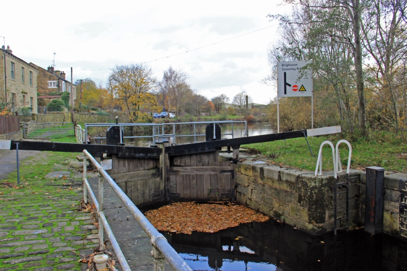
CALDER AND HEBBLE NAVIGATION
1.
5113
KIRKLEES CUT
Anchor Lock
SE 1521 7/286
II
2.
C18. Stone retaining walls. Water level marked by incised Roman numerals.
Iron mooring hooks. 2 pairs, of timber lock gates.
Listing NGR: SE1596321796
This text is from the original listing, and may not necessarily reflect the current setting of the building.
External links are from the relevant listing authority and, where applicable, Wikidata. Wikidata IDs may be related buildings as well as this specific building. If you want to add or update a link, you will need to do so by editing the Wikidata entry.


Other nearby listed buildings
