Approximate Location Map
Large Map »
Latitude: 54.5404 / 54°32'25"N
Longitude: -1.9246 / 1°55'28"W
OS Eastings: 404978
OS Northings: 516123
OS Grid: NZ049161
Mapcode National: GBR HH0Y.45
Mapcode Global: WHB4L.D4SM
Plus Code: 9C6WG3RG+45
Entry Name: Charlton House and Attached Rear Wall Charlton House, Thorngate
Listing Date: 22 February 1973
Grade: II
Source: Historic England
Source ID: 1291743
English Heritage Legacy ID: 388836
ID on this website: 101291743
Location: Startforth, County Durham, DL12
County: County Durham
Civil Parish: Barnard Castle
Built-Up Area: Barnard Castle
Traditional County: Durham
Lieutenancy Area (Ceremonial County): County Durham
Church of England Parish: Barnard Castle with Whorlton
Church of England Diocese: Durham
Tagged with: Architectural structure
BARNARD CASTLE
NZ0416SE THORNGATE
770-1/5/208 (East side)
22/02/73 No.2
Charlton House and attached rear
wall
GV II
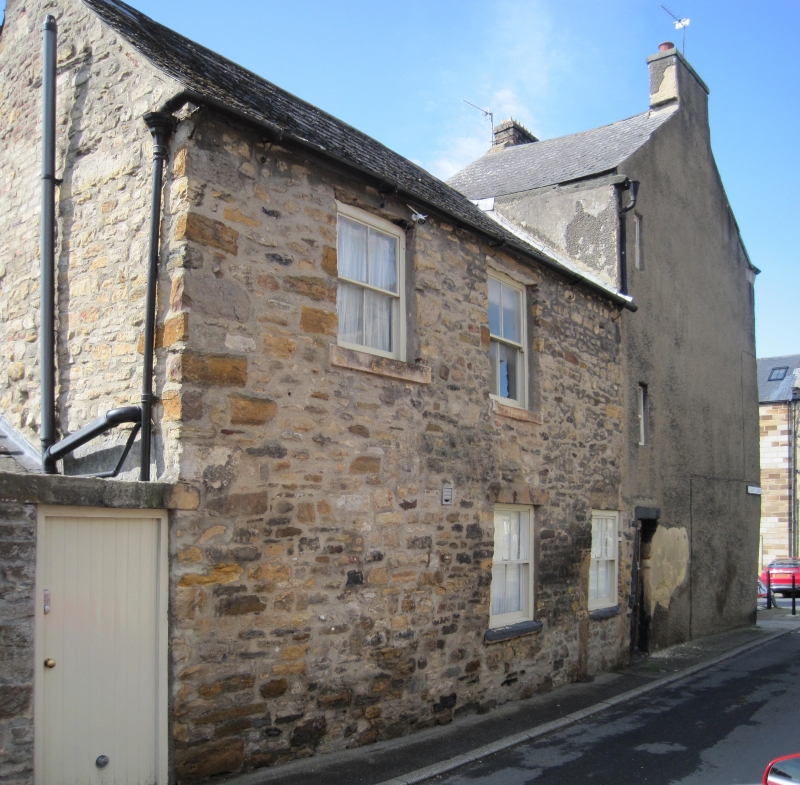
House with rear outbuildings, and walls attached. Mid-late C18
with C19 alterations. Render with painted ashlar dressings;
rear wing rubble with ashlar dressings; roof thin asbestos
tiles in imitation of Welsh slate, with stone gable copings
and rendered chimney.
EXTERIOR: 3 storeys; one-window range, and 2-storey, 2-window,
rear wing. 4-panel door and small overlight at right and
canted bay window with colonnettes on wood mullions at left
under continuous wood entablature. Painted plain stone
surround to tall first-floor window. Plain sashes on ground
floor and 4-pane on first. Similar jambs and head, but sill
altered, to C20 glazing in paired smaller lights on top floor,
possibly for weaver's work. Roof has gable copings on moulded
kneelers, and left end chimney. Left return has half-glazed
C20 door towards rear, and small lights above on each floor.
Rear wing has 4-pane sashes in windows of irregular size and
spacing with flat stone lintels and projecting stone sills.
Outbuildings of one low storey have stone slate roofs.
INTERIOR: not inspected.
SUBSIDIARY FEATURES: high rear wall of rubble with flat stone
coping continues around north side of property forming part of
south side of Gray Lane.
Listing NGR: NZ0497616125
External links are from the relevant listing authority and, where applicable, Wikidata. Wikidata IDs may be related buildings as well as this specific building. If you want to add or update a link, you will need to do so by editing the Wikidata entry.


Other nearby listed buildings
