Approximate Location Map
Large Map »
Latitude: 53.0175 / 53°1'2"N
Longitude: -1.733 / 1°43'58"W
OS Eastings: 418005
OS Northings: 346717
OS Grid: SK180467
Mapcode National: GBR 48Q.SSS
Mapcode Global: WHCF5.BFZ3
Plus Code: 9C5W2788+XQ
Entry Name: Surface of Victoria Square
Listing Date: 14 February 1974
Grade: II
Source: Historic England
Source ID: 1293138
English Heritage Legacy ID: 79943
ID on this website: 101293138
Location: Ashbourne, Derbyshire Dales, Derbyshire, DE6
County: Derbyshire
District: Derbyshire Dales
Civil Parish: Ashbourne
Built-Up Area: Ashbourne
Traditional County: Derbyshire
Lieutenancy Area (Ceremonial County): Derbyshire
Church of England Parish: Ashbourne St Oswald
Church of England Diocese: Derby
Tagged with: Square Road surface
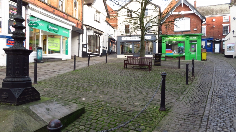
VICTORIA SQUARE
1.
783
(East Side)
Surface of
Victoria Square
SK 14 NE 1/191
II GV
2.
C18 or early C19 or earlier. Paved surface of limestone setts and flagstones
with narrow modern surfaced footway through centre.
All the listed buildings in Victoria Square form a group.
Listing NGR: SK1800546717
External links are from the relevant listing authority and, where applicable, Wikidata. Wikidata IDs may be related buildings as well as this specific building. If you want to add or update a link, you will need to do so by editing the Wikidata entry.


Other nearby listed buildings
