Approximate Location Map
Large Map »
Latitude: 52.9753 / 52°58'31"N
Longitude: -1.8938 / 1°53'37"W
OS Eastings: 407226
OS Northings: 341997
OS Grid: SK072419
Mapcode National: GBR 37R.G0F
Mapcode Global: WHBD4.WGCY
Plus Code: 9C4WX4G4+4F
Entry Name: Village Pump and Attached Trough
Listing Date: 17 November 1986
Grade: II
Source: Historic England
Source ID: 1293529
English Heritage Legacy ID: 275016
ID on this website: 101293529
Location: Alton, Staffordshire Moorlands, Staffordshire, ST10
County: Staffordshire
District: Staffordshire Moorlands
Civil Parish: Alton
Built-Up Area: Alton
Traditional County: Staffordshire
Lieutenancy Area (Ceremonial County): Staffordshire
Church of England Parish: Alton St Peter
Church of England Diocese: Lichfield
Tagged with: Well
SK 04 SE
7/20
ALTON C.P.
DIMBLE LANE (West side)
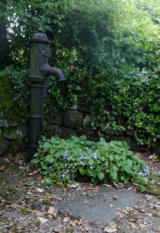
Village pump and attached trough.
GV
II
Water pump and trough. Late C19. Cast iron pump and stone trough.
Cylindrical shaft with enlarged head; curved spout and handle.
Listing NGR: SK0722641997
External links are from the relevant listing authority and, where applicable, Wikidata. Wikidata IDs may be related buildings as well as this specific building. If you want to add or update a link, you will need to do so by editing the Wikidata entry.


Other nearby listed buildings
