Approximate Location Map
Large Map »
Latitude: 52.8554 / 52°51'19"N
Longitude: -0.9081 / 0°54'29"W
OS Eastings: 473617
OS Northings: 329211
OS Grid: SK736292
Mapcode National: GBR BMP.Z3Q
Mapcode Global: WHFJM.0HTC
Plus Code: 9C4XV34R+4P
Entry Name: Old Farmhouse
Listing Date: 16 January 1974
Last Amended: 26 February 1992
Grade: II
Source: Historic England
Source ID: 1294968
English Heritage Legacy ID: 190105
ID on this website: 101294968
Location: Hose, Melton, Leicestershire, LE14
County: Leicestershire
District: Melton
Civil Parish: Clawson, Hose and Harby
Built-Up Area: Hose
Traditional County: Leicestershire
Lieutenancy Area (Ceremonial County): Leicestershire
Church of England Parish: Hose St Michael and All Angels
Church of England Diocese: Leicester
Tagged with: Farmhouse
In the entry for
CLAWSON, HOSE BOLTON LANE
SK 72 NW AND HARBY (west side)
9/29 Hose
16.1.74 Old Farmhouse
GV II
The address shall be amended to read
SK 72 NW CLAWSON, HOSE BOLTON LANE
AND HARBY (west side)
9/29 Hose
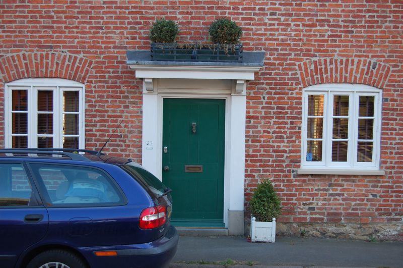
16.1.74 Old Farmhouse (No 23)
GV II
------------------------------------
CLAWSON, HOSE BOLTON LANE
AND HARBY (West side),
HOSE
SK 72 NW Old Farmhouse
9/29
16.1.74
GV II
Former farmhouse. Early C18, extended later C18, altered C19 and C20. Red
brick in irregular, mostly stretcher bond, pantile roofs, brick end and
ridge stacks. 2-unit plan originally with central staircase, and 2 storeys
and attic; 2-window range. Street elevation is rendered and re-windowed
C20. Brickwork visible to garden elevation, which has 'French' window to
far left with flat-arched head, a 3-light casement window to ground floor
with cemented head, similar casement above and 2-light casement to 1st floor
far left, with brick lintels. Ironstone plinth with stepped brick step and
cogged brick eaves, 2-storey extension to right of centre probably
incorporates 1 storey and attic service building raised to full height and
has irregular glazing of one, two and three-light casements. Further 1
storey and attic extension, mostly C20, to far right. Interior: Ogee stop-
chamfered spine beams. Dog-leg staircase with straight string, turned
balusters and square newel posts running from ground floor to attic. Collar
truss roof with 1 tier of clasped purlins and old rafters, partly original.
Listing NGR: SK7361729211
External links are from the relevant listing authority and, where applicable, Wikidata. Wikidata IDs may be related buildings as well as this specific building. If you want to add or update a link, you will need to do so by editing the Wikidata entry.


Other nearby listed buildings
