Approximate Location Map
Large Map »
Latitude: 54.047 / 54°2'49"N
Longitude: -2.8032 / 2°48'11"W
OS Eastings: 347506
OS Northings: 461528
OS Grid: SD475615
Mapcode National: GBR 8PVN.X0
Mapcode Global: WH846.XJBT
Plus Code: 9C6V25WW+RP
Entry Name: 6, High Street
Listing Date: 22 December 1953
Last Amended: 13 March 1995
Grade: II
Source: Historic England
Source ID: 1298374
English Heritage Legacy ID: 383163
ID on this website: 101298374
Location: Lancaster, Lancashire, LA1
County: Lancashire
District: Lancaster
Electoral Ward/Division: Castle
Parish: Non Civil Parish
Built-Up Area: Lancaster
Traditional County: Lancashire
Lieutenancy Area (Ceremonial County): Lancashire
Church of England Parish: Lancaster St Mary with St John and St Anne
Church of England Diocese: Blackburn
Tagged with: Building
LANCASTER
SD4761NE HIGH STREET
1685-1/7/129 (West side)
22/12/53 No.6
(Formerly Listed as:
HIGH STREET
St Anne's Vicarage)
GV II
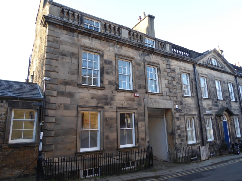
House. c1775, altered C19. Sandstone ashlar with ashlar
dressings and chamfered quoins, and coursed rubble to the side
elevation. Slate roof with a gable stack to the left. 2
storeys with an attic and a basement, and 3 bays of which the
right-hand one on the ground floor is a lintelled waggon
entrance with the front door of the house, of 6 raised and
fielded panels, in its left-hand return wall. To left is a mid
C19 single-storey extension. All the windows have moulded
architraves; those above have 12-pane sashes, those below
4-pane sashes. Over all is a pronounced cornice with a
balustrade. A number of balusters have been removed (probably
early in the building's life) to accommodate 2 dormer windows
over bays one and 3. The cast-iron area railings have urn
finials on the standards and scrolled brackets at each end.
INTERIOR: the partition wall to the right of the cellar
contains large segmental arches at a low level.
Listing NGR: SD4750661528
External links are from the relevant listing authority and, where applicable, Wikidata. Wikidata IDs may be related buildings as well as this specific building. If you want to add or update a link, you will need to do so by editing the Wikidata entry.


Other nearby listed buildings
