Approximate Location Map
Large Map »
Latitude: 51.3464 / 51°20'47"N
Longitude: -2.2562 / 2°15'22"W
OS Eastings: 382249
OS Northings: 160846
OS Grid: ST822608
Mapcode National: GBR 1SC.DDV
Mapcode Global: VH96V.VF25
Plus Code: 9C3V8PWV+HG
Entry Name: Ramped Path to Right at South End of Well Path Wall in Front of Builder's Yard
Listing Date: 23 August 1974
Grade: II
Source: Historic England
Source ID: 1300264
English Heritage Legacy ID: 312637
ID on this website: 101300264
Location: Bradford-on-Avon, Wiltshire, BA15
County: Wiltshire
Civil Parish: Bradford-on-Avon
Built-Up Area: Bradford on Avon
Traditional County: Wiltshire
Lieutenancy Area (Ceremonial County): Wiltshire
Church of England Parish: Bradford-on-Avon Holy Trinity
Church of England Diocese: Salisbury
Tagged with: Architectural structure
1. NEWTOWN
5411 (North Side)
Wall in front of Builder's
Yard
Ramped Path to
right at South end of
Well Path
ST 8260 2/242
II GV
2.
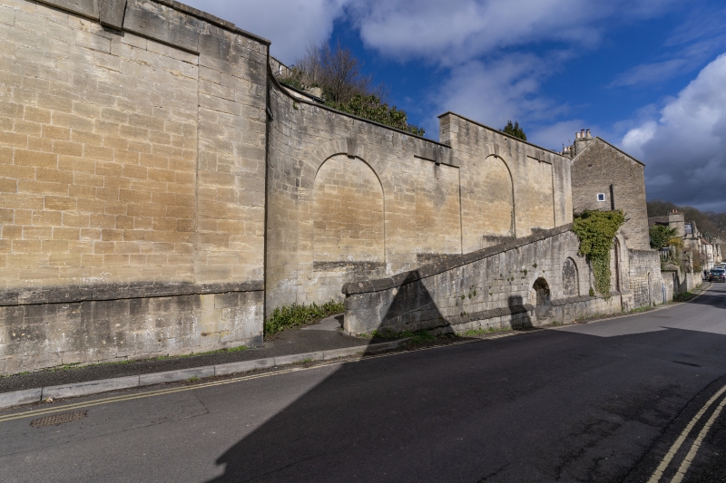
Mid to late C19. Ashlar of heights varying from 15 to 20ft. One large
round-headed archway with shouldered soffits and keystone to main yard.
This archway is flanked by two round-headed recessed (blind) panels,
also with keystones. To the outside of these are similar square-headed
panels. Continuous plinth. Some stellar-shaped braces. To the right
the wall curves back about 5 or 6 ft from the road to accomodate a sloping
ramp which leads up to the right. The path which the ramp carries continues
up the hill diagonally and is known as Well Path. The main wall behind
this ramp has 4 recessed panels as before, alternately round and square-headed.
In front, and supporting the path, is a wedge-shaped wall with 4 recessed
panels of increasing size towards right. These are all round-headed,
the smallest to left containing a well known as Lady Well. Sloping parapet
with chamfered coping running up the incline, Projecting plinth.
Nos 5 and 6 form a group with Nos 27 to 31 (consec) and wall Newtown and
Nos 7 and 9 to 19 (consec) Barton Orchard, all the listed buildings in
Church Street, The Chantry and Little Chantry, and the Catholic Church
of St Thomas More, Market Street.
Listing NGR: ST8224960846
External links are from the relevant listing authority and, where applicable, Wikidata. Wikidata IDs may be related buildings as well as this specific building. If you want to add or update a link, you will need to do so by editing the Wikidata entry.


Other nearby listed buildings
