Approximate Location Map
Large Map »
Latitude: 51.8225 / 51°49'21"N
Longitude: -1.6628 / 1°39'46"W
OS Eastings: 423334
OS Northings: 213819
OS Grid: SP233138
Mapcode National: GBR 5SN.LFT
Mapcode Global: VHBZS.4G86
Plus Code: 9C3WR8FP+2V
Entry Name: 41, Taynton
Listing Date: 12 September 1955
Grade: II
Source: Historic England
Source ID: 1300573
English Heritage Legacy ID: 253716
ID on this website: 101300573
Location: Taynton, West Oxfordshire, OX18
County: Oxfordshire
District: West Oxfordshire
Civil Parish: Taynton
Traditional County: Oxfordshire
Lieutenancy Area (Ceremonial County): Oxfordshire
Church of England Parish: Taynton
Church of England Diocese: Oxford
Tagged with: Building
TAYNTON
SP2313
10/158 No.41
12/09/55
GV II
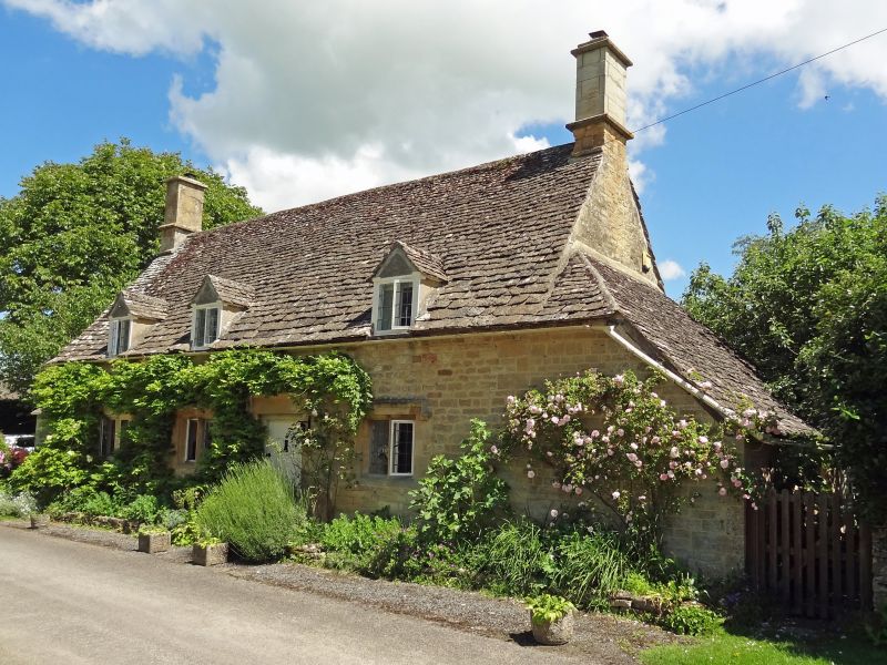
House. C17. Coursed stone rubble; stone slate roof; stone end stacks. Single
storey and attic; 3-window range. Plank door to right of centre. 2-light stone
mullion windows with hood moulds to ground floor left of centre, and to right.
2-light casement to left with hood mould. 3 gabled dormers with 2-light
casements. Interior not inspected.
Listing NGR: SP2333413819
External links are from the relevant listing authority and, where applicable, Wikidata. Wikidata IDs may be related buildings as well as this specific building. If you want to add or update a link, you will need to do so by editing the Wikidata entry.


Other nearby listed buildings
