Approximate Location Map
Large Map »
Latitude: 53.7837 / 53°47'1"N
Longitude: -1.071 / 1°4'15"W
OS Eastings: 461311
OS Northings: 432333
OS Grid: SE613323
Mapcode National: GBR NSYP.YC
Mapcode Global: WHFD2.J575
Plus Code: 9C5WQWMH+FJ
Entry Name: 19 and 21, Gowthorpe
Listing Date: 14 November 1980
Grade: II
Source: Historic England
Source ID: 1301030
English Heritage Legacy ID: 325745
ID on this website: 101301030
Location: Selby, North Yorkshire, YO8
County: North Yorkshire
District: Selby
Civil Parish: Selby
Built-Up Area: Selby
Traditional County: Yorkshire
Lieutenancy Area (Ceremonial County): North Yorkshire
Church of England Parish: Selby St James
Church of England Diocese: York
Tagged with: Building
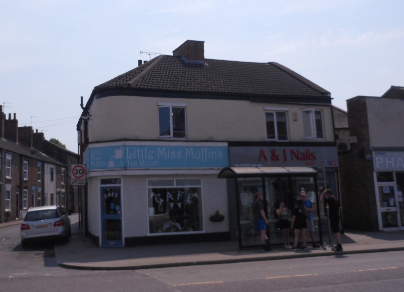
GOWTHORPE
1. (south side)
5342 ------------
Nos 19 and 21
SE 6132 SW 4/63
II GV
2.
Not dated, but as it is a complementary design to Nos 15 and 17, presumably
also 1810. White-washed brick. Hipped slate roof. Two storeys. Two flush-
framed sashes with glazing bars on first floor of Audus Street elevation.
Modern shop-fronts.
Listing NGR: SE6131132333
External links are from the relevant listing authority and, where applicable, Wikidata. Wikidata IDs may be related buildings as well as this specific building. If you want to add or update a link, you will need to do so by editing the Wikidata entry.


Other nearby listed buildings
