Approximate Location Map
Large Map »
Latitude: 52.7193 / 52°43'9"N
Longitude: -0.7661 / 0°45'58"W
OS Eastings: 483438
OS Northings: 314234
OS Grid: SK834142
Mapcode National: GBR CQY.K3Y
Mapcode Global: WHFK8.6XF5
Plus Code: 9C4XP69M+PG
Entry Name: 3, Ashwell Road
Listing Date: 21 February 1984
Grade: II
Source: Historic England
Source ID: 1307249
English Heritage Legacy ID: 186718
ID on this website: 101307249
Location: Whissendine, Rutland, LE15
County: Rutland
Civil Parish: Whissendine
Built-Up Area: Whissendine
Traditional County: Rutland
Lieutenancy Area (Ceremonial County): Rutland
Church of England Parish: Whissendine St Andrew
Church of England Diocese: Peterborough
Tagged with: Building
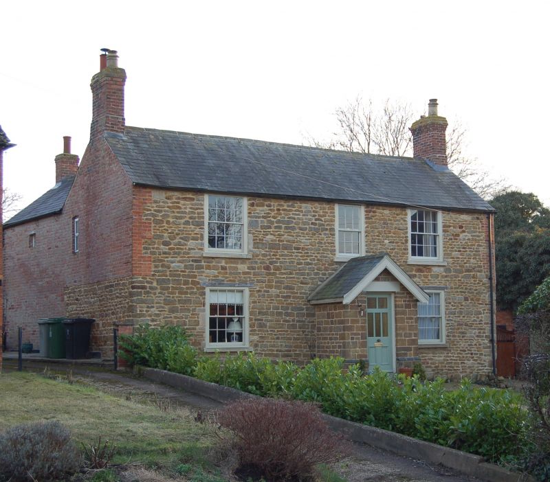
WHISSENDINE
SK 81 SW ASHWELL ROAD (South side)
5/148 No.3
II
House of c1800. Coursed rubble stone and Welsh slate roof with brick
end stacks. 2 storeys of 3 sash windows, 8/8 either side a central 6/6
over C20 stone porch and door.
Listing NGR: SK8343814234
External links are from the relevant listing authority and, where applicable, Wikidata. Wikidata IDs may be related buildings as well as this specific building. If you want to add or update a link, you will need to do so by editing the Wikidata entry.


Other nearby listed buildings
