Approximate Location Map
Large Map »
Latitude: 51.9092 / 51°54'33"N
Longitude: -0.2067 / 0°12'24"W
OS Eastings: 523454
OS Northings: 224928
OS Grid: TL234249
Mapcode National: GBR J7W.8JV
Mapcode Global: VHGP0.C8LQ
Plus Code: 9C3XWQ5V+M8
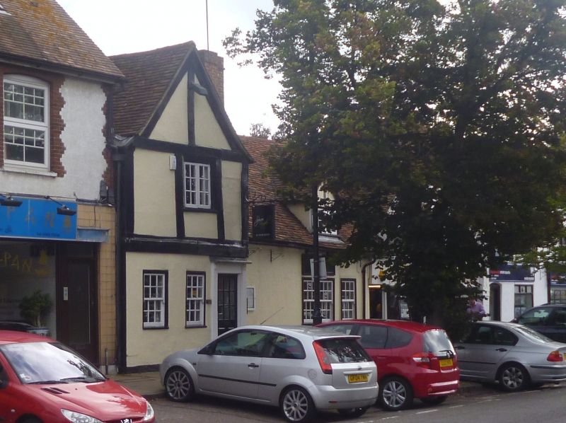
Entry Name: 123 and 125, High Street
Listing Date: 18 February 1948
Grade: II
Source: Historic England
Source ID: 1307868
English Heritage Legacy ID: 158052
ID on this website: 101307868
Location: Old Town, Stevenage, Hertfordshire, SG1
County: Hertfordshire
District: Stevenage
Electoral Ward/Division: Old Town
Parish: Non Civil Parish
Built-Up Area: Stevenage
Traditional County: Hertfordshire
Lieutenancy Area (Ceremonial County): Hertfordshire
Church of England Parish: Stevenage Holy Trinity
Church of England Diocese: St.Albans
Tagged with: Building
1.
5257 HIGH STREET
(East Side)
-----------
Nos 123 and 125
TL 2324 3/21 18.2.48.
II GV
Cl7, altered. Stucco front, steeply pitched tiled roofs. 2 storeys and attics,
2 gabled dormers. Casement window.
Nos 123 to 131 (odd) form a group.
Listing NGR: TL2345424928
External links are from the relevant listing authority and, where applicable, Wikidata. Wikidata IDs may be related buildings as well as this specific building. If you want to add or update a link, you will need to do so by editing the Wikidata entry.


Other nearby listed buildings
