Approximate Location Map
Large Map »
Latitude: 52.1922 / 52°11'31"N
Longitude: -0.0646 / 0°3'52"W
OS Eastings: 532390
OS Northings: 256645
OS Grid: TL323566
Mapcode National: GBR K5X.GH2
Mapcode Global: VHGMQ.T5QB
Plus Code: 9C4X5WRP+V5
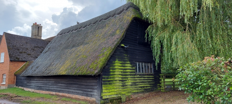
Entry Name: Barn to North of Home Farmhouse
Listing Date: 31 May 1985
Grade: II
Source: Historic England
Source ID: 1309567
English Heritage Legacy ID: 51071
ID on this website: 101309567
Location: Bourn, South Cambridgeshire, CB23
County: Cambridgeshire
District: South Cambridgeshire
Civil Parish: Bourn
Built-Up Area: Bourn
Traditional County: Cambridgeshire
Lieutenancy Area (Ceremonial County): Cambridgeshire
Church of England Parish: Bourn St Helena and St Mary
Church of England Diocese: Ely
Tagged with: Barn
TL 3256-3356 BOURN RIDDY LANE
(North-West Side)
15/94 Barn to north of
Home Farmhouse
II
Barn. C17. Timber-framed and weatherboarded red brick foundations.
Corrugated iron roof. Three timber-framed bays with single aisle to north
and entry facing west.
Listing NGR: TL3239056645
External links are from the relevant listing authority and, where applicable, Wikidata. Wikidata IDs may be related buildings as well as this specific building. If you want to add or update a link, you will need to do so by editing the Wikidata entry.


Other nearby listed buildings
