Approximate Location Map
Large Map »
Latitude: 51.57 / 51°34'12"N
Longitude: -0.5012 / 0°30'4"W
OS Eastings: 503969
OS Northings: 186745
OS Grid: TQ039867
Mapcode National: GBR 07.Q9R
Mapcode Global: VHFSY.8SCT
Plus Code: 9C3XHFCX+2G
Entry Name: Denham Methodist Church
Listing Date: 26 April 1985
Grade: II
Source: Historic England
Source ID: 1309730
English Heritage Legacy ID: 43927
ID on this website: 101309730
Location: Denham, Buckinghamshire, UB9
County: Buckinghamshire
Civil Parish: Denham
Built-Up Area: Denham
Traditional County: Buckinghamshire
Lieutenancy Area (Ceremonial County): Buckinghamshire
Church of England Parish: Denham
Church of England Diocese: Oxford
Tagged with: Protestant church building
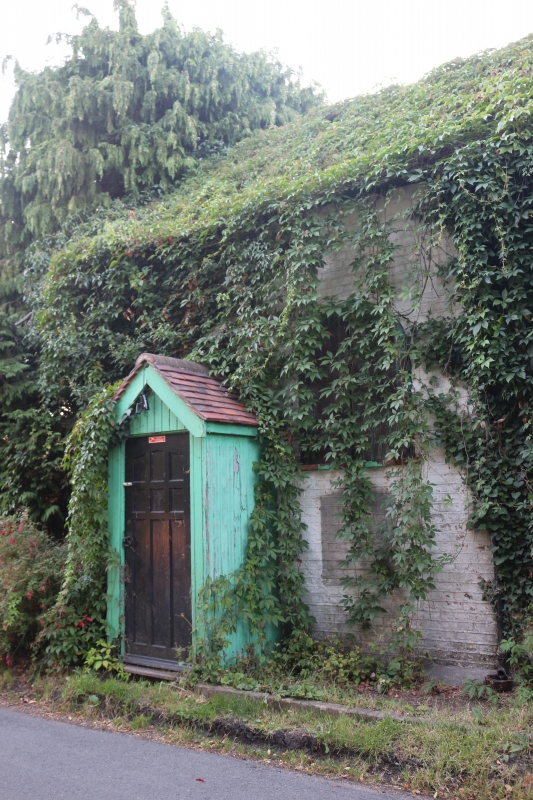
TQ 08 NW DENHAM CHEAPSIDE LANE
5/303 Denham Methodist Church
- II
Colourwashed brick; old tile roof. One storey. Two round-headed casements
with leaded lights. Later closed wooded porch with, above, a plaque reading
'Weslyan Chapel 1820'.
Listing NGR: TQ0396986745
External links are from the relevant listing authority and, where applicable, Wikidata. Wikidata IDs may be related buildings as well as this specific building. If you want to add or update a link, you will need to do so by editing the Wikidata entry.


Other nearby listed buildings
