Approximate Location Map
Large Map »
Latitude: 51.9293 / 51°55'45"N
Longitude: -0.5845 / 0°35'4"W
OS Eastings: 497425
OS Northings: 226594
OS Grid: SP974265
Mapcode National: GBR F30.WL1
Mapcode Global: VHFR4.TRCT
Plus Code: 9C3XWCH8+P6
Entry Name: Congregational Chapel
Listing Date: 26 September 1980
Grade: II
Source: Historic England
Source ID: 1311367
English Heritage Legacy ID: 35995
ID on this website: 101311367
Location: Hockliffe, Central Bedfordshire, LU7
County: Central Bedfordshire
Civil Parish: Hockliffe
Built-Up Area: Hockliffe
Traditional County: Bedfordshire
Lieutenancy Area (Ceremonial County): Bedfordshire
Church of England Parish: Hockliffe
Church of England Diocese: St.Albans
Tagged with: Chapel
1.
5125 HOCKLIFFE WATLING STREET
(south-west side)
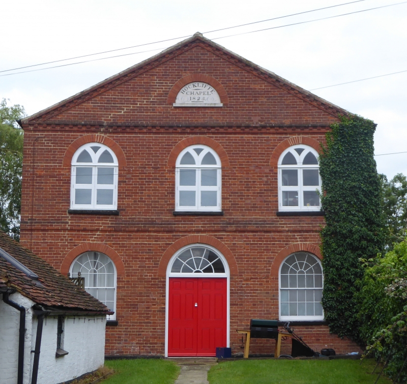
Congregational Chapel
SP 9726 13/168
II
2.
Early C19. Red brick. Slate roof. Pediment, Modillion brick eaves, 3 casement
windows with circular heads to first floor. First floor band. Two sash windows
with glazing bars to ground floor. Double doors with fanlight.
Listing NGR: SP9742526594
External links are from the relevant listing authority and, where applicable, Wikidata. Wikidata IDs may be related buildings as well as this specific building. If you want to add or update a link, you will need to do so by editing the Wikidata entry.


Other nearby listed buildings
