Approximate Location Map
Large Map »
Latitude: 53.0118 / 53°0'42"N
Longitude: -2.7543 / 2°45'15"W
OS Eastings: 349485
OS Northings: 346318
OS Grid: SJ494463
Mapcode National: GBR 7H.G9GS
Mapcode Global: WH898.NKMG
Plus Code: 9C5V266W+P7
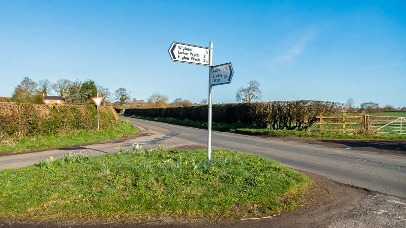
Entry Name: Guidepost
Listing Date: 28 August 1985
Grade: II
Source: Historic England
Source ID: 1312878
English Heritage Legacy ID: 55620
ID on this website: 101312878
Location: Cheshire West and Chester, Cheshire, SY14
County: Cheshire West and Chester
Civil Parish: Malpas
Traditional County: Cheshire
Lieutenancy Area (Ceremonial County): Cheshire
Church of England Parish: Malpas St Oswald
Church of England Diocese: Chester
Tagged with: Fingerpost
MALPAS C.P. WHITCHURCH ROAD (B5395)/
SJ 44 NE
4961 4638 HIGHER WYCH LANE
2/77 Guidepost
II
Guidepost, probably 1870's, of cast iron. Octagonal shaft has CCC
embossed in ornate letters on raised shield. Plates with pecked
corners and raised margins direct to MALPAS and HIGHER WYCH in raised
sans-serif capitals. Ball finial.
Listing NGR: SJ4948546318
External links are from the relevant listing authority and, where applicable, Wikidata. Wikidata IDs may be related buildings as well as this specific building. If you want to add or update a link, you will need to do so by editing the Wikidata entry.


Other nearby listed buildings
