Approximate Location Map
Large Map »
Latitude: 53.9054 / 53°54'19"N
Longitude: -1.6945 / 1°41'40"W
OS Eastings: 420169
OS Northings: 445515
OS Grid: SE201455
Mapcode National: GBR JRL8.YR
Mapcode Global: WHC8X.Y38C
Plus Code: 9C5WW844+56
Entry Name: 11 and 13, Kirkgate
Listing Date: 8 July 1974
Grade: II
Source: Historic England
Source ID: 1313373
English Heritage Legacy ID: 341439
ID on this website: 101313373
Location: Otley, Leeds, West Yorkshire, LS21
County: Leeds
Civil Parish: Otley
Built-Up Area: Otley
Traditional County: Yorkshire
Lieutenancy Area (Ceremonial County): West Yorkshire
Church of England Parish: Otley All Saints
Church of England Diocese: Leeds
Tagged with: Building
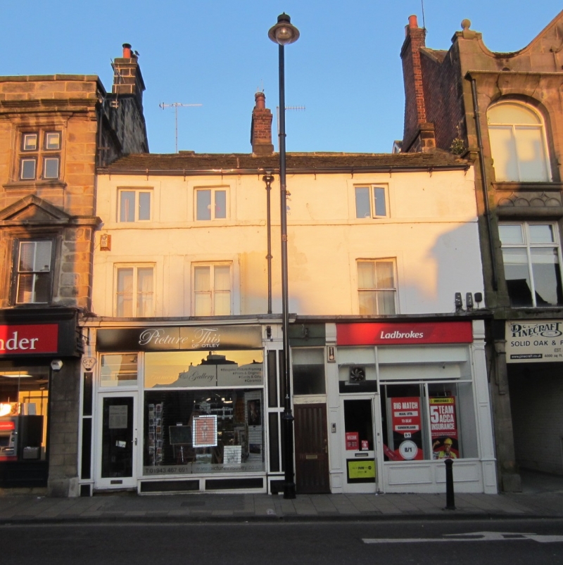
Kirkgate
1.
l480
(West Side)
Nos 11 and 13
SE 2045 1/184
II GV
2.
C18. Three storeys, rendered, with stone slate roof with brick stacks.
2-1 windows, stone architraves; band continues top floor cills. Modern
shop fronts.
Nos 11 to 25 (odd) form a group.
Listing NGR: SE2016945515
External links are from the relevant listing authority and, where applicable, Wikidata. Wikidata IDs may be related buildings as well as this specific building. If you want to add or update a link, you will need to do so by editing the Wikidata entry.


Other nearby listed buildings
