Approximate Location Map
Large Map »
Latitude: 53.6208 / 53°37'14"N
Longitude: -1.7645 / 1°45'52"W
OS Eastings: 415674
OS Northings: 413833
OS Grid: SE156138
Mapcode National: GBR JV3K.SS
Mapcode Global: WHCB7.V8Y1
Plus Code: 9C5WJ6CP+86
Entry Name: The Lumb
Listing Date: 15 October 1975
Last Amended: 29 September 1978
Grade: II
Source: Historic England
Source ID: 1313526
English Heritage Legacy ID: 340197
ID on this website: 101313526
Location: The Lumb, Kirklees, West Yorkshire, HD4
County: Kirklees
Electoral Ward/Division: Almondbury
Parish: Non Civil Parish
Traditional County: Yorkshire
Lieutenancy Area (Ceremonial County): West Yorkshire
Church of England Parish: Almondbury with Farnley Tyas Team Parish
Church of England Diocese: Leeds
Tagged with: Architectural structure
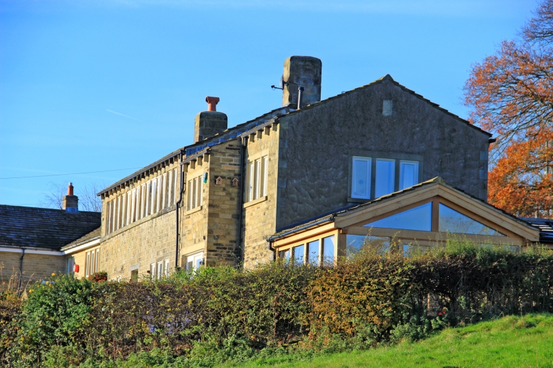
LUMB LANE
1.
5113
(North Side)
Almondbury
The Lumb
(formerly listed
SE 1513 48/55 15.2.74. as The Lumbs)
II GV
2.
C18. Hammer-dressed stone. Pitched stone slate roof. 2 storeys. One 14-light stone mullioned window on 1st floor. 2 3-light stone mullioned windows on ground floor.
Listing NGR: SE1567413833
External links are from the relevant listing authority and, where applicable, Wikidata. Wikidata IDs may be related buildings as well as this specific building. If you want to add or update a link, you will need to do so by editing the Wikidata entry.


Other nearby listed buildings
