Approximate Location Map
Large Map »
Latitude: 53.571 / 53°34'15"N
Longitude: -1.8328 / 1°49'58"W
OS Eastings: 411167
OS Northings: 408280
OS Grid: SE111082
Mapcode National: GBR HWM4.ZM
Mapcode Global: WHCBD.THDR
Plus Code: 9C5WH5C8+CV
Entry Name: 2 Miles Post
Listing Date: 4 August 1983
Grade: II
Source: Historic England
Source ID: 1313569
English Heritage Legacy ID: 340339
ID on this website: 101313569
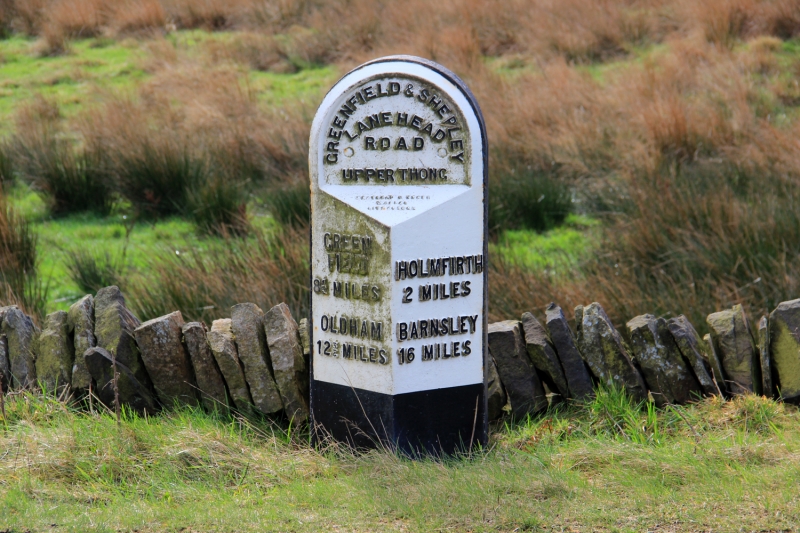
SE 10 MW GREENFIELD ROAD
4/112 (Upperthong)
2 Miles Post
II
Mile post. Mid-late C19. Cast iron triangular front with rounded top, on stone
post. Reads: GREENFIELD & SHEPLEY
LANE HEAD
ROAD
UPPERTHONG
GREEN HOLMFIRTH
FIELD 2 MILES
8½ MILES BARNSLEY
OLDHAM 16 MILES
12¾ MILES
Listing NGR: SE1116708280
External links are from the relevant listing authority and, where applicable, Wikidata. Wikidata IDs may be related buildings as well as this specific building. If you want to add or update a link, you will need to do so by editing the Wikidata entry.


Other nearby listed buildings
