Approximate Location Map
Large Map »
Latitude: 53.6625 / 53°39'44"N
Longitude: -1.8214 / 1°49'17"W
OS Eastings: 411899
OS Northings: 418456
OS Grid: SE118184
Mapcode National: GBR HVQ2.GV
Mapcode Global: WHCB0.Z6TM
Plus Code: 9C5WM56H+XC
Entry Name: East Royd
Listing Date: 29 September 1978
Grade: II
Source: Historic England
Source ID: 1313853
English Heritage Legacy ID: 339803
ID on this website: 101313853
Location: Birchencliffe, Kirklees, West Yorkshire, HD3
County: Kirklees
Electoral Ward/Division: Lindley
Parish: Non Civil Parish
Built-Up Area: Huddersfield
Traditional County: Yorkshire
Lieutenancy Area (Ceremonial County): West Yorkshire
Church of England Parish: Lindley St Stephen
Church of England Diocese: Leeds
Tagged with: Architectural structure
EAST STREET
1.
5113
(South Side)
East Royd
SE 1118 20/476
II
2.
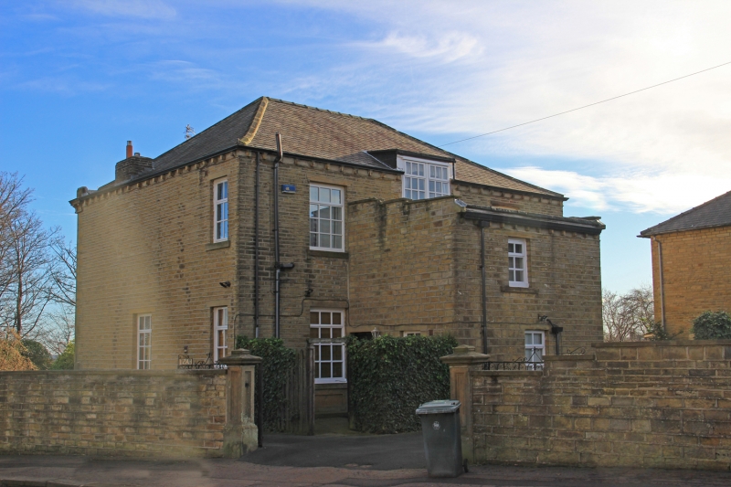
Mid C19. Ashlar. Hipped slate roof. 2 storeys. Modillioned eaves cornice.
Blocking course. Rusticated quoins. 3 ranges of sashes, of which central
one breaks forward. Door masked by early C20 porch (timber with modillioned
cornice and lead glazing bars).
Listing NGR: SE1189918456
External links are from the relevant listing authority and, where applicable, Wikidata. Wikidata IDs may be related buildings as well as this specific building. If you want to add or update a link, you will need to do so by editing the Wikidata entry.


Other nearby listed buildings
