Approximate Location Map
Large Map »
Latitude: 54.2348 / 54°14'5"N
Longitude: -1.3466 / 1°20'47"W
OS Eastings: 442686
OS Northings: 482322
OS Grid: SE426823
Mapcode National: GBR MM1G.8P
Mapcode Global: WHD8H.9T0C
Plus Code: 9C6W6MM3+W9
Entry Name: Thirsk Hall Cottages
Listing Date: 20 June 1966
Last Amended: 25 March 1997
Grade: II
Source: Historic England
Source ID: 1314930
English Heritage Legacy ID: 333282
ID on this website: 101314930
Location: Norby, North Yorkshire, YO7
County: North Yorkshire
District: Hambleton
Civil Parish: Thirsk
Built-Up Area: Thirsk
Traditional County: Yorkshire
Lieutenancy Area (Ceremonial County): North Yorkshire
Tagged with: Cottage
SE 4282 THIRSK CEMETERY ROAD
(west side)
157/6/42
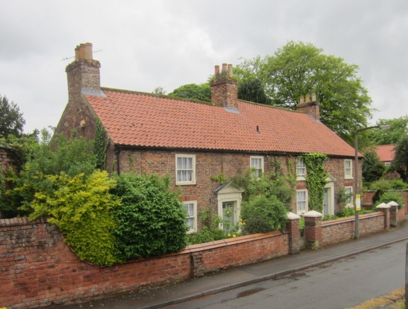
Thirsk Hall Cottages
20.06.1966 Nos 1 & 2
GV II
2 cottages. C18 and early C19. Reddish-brown brick. No 1 has cogged eaves. Pantile roofs. 2 storeys, 2 bays. No 2, the later cottage, is slightly higher than the other. Central entrances with panelled doors in wooden cases with pilasters, moulded architraves and dentilled triangular pediments. Squat sash windows in flush moulded cases. Group value with St Mary's Church and Thirsk Hall wall.
Listing NGR: SE4268782323
External links are from the relevant listing authority and, where applicable, Wikidata. Wikidata IDs may be related buildings as well as this specific building. If you want to add or update a link, you will need to do so by editing the Wikidata entry.


Other nearby listed buildings
