Approximate Location Map
Large Map »
Latitude: 53.9602 / 53°57'36"N
Longitude: -1.5353 / 1°32'7"W
OS Eastings: 430588
OS Northings: 451669
OS Grid: SE305516
Mapcode National: GBR KQQN.D3
Mapcode Global: WHC8M.DQ4D
Plus Code: 9C5WXF67+3V
Entry Name: 12, Main Street
Listing Date: 4 February 1975
Grade: II
Source: Historic England
Source ID: 1315849
English Heritage Legacy ID: 329889
ID on this website: 101315849
Location: Pannal, North Yorkshire, HG3
County: North Yorkshire
District: Harrogate
Civil Parish: Pannal and Burn Bridge
Built-Up Area: Pannal
Traditional County: Yorkshire
Lieutenancy Area (Ceremonial County): North Yorkshire
Church of England Parish: Pannal St Robert of Knaresborough
Church of England Diocese: Leeds
Tagged with: Building
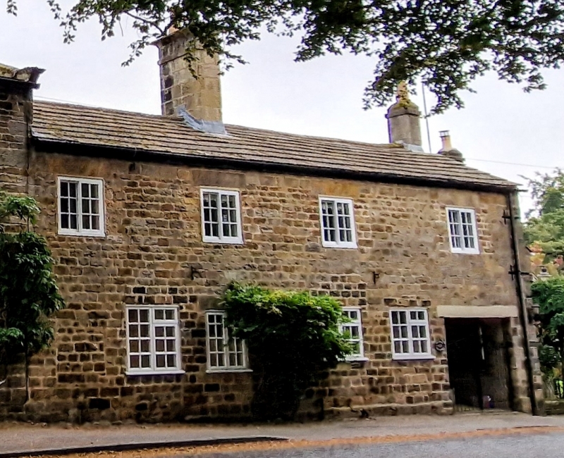
MAIN STREET
1.
5338
(East Side)
PANNAL
No 12
SE 3051 37/115
II
2.
Early C19, formerly 2 cottages with 2 windows each, now one residence. Slated
roof with carved ridge stack. Grit stone rubble. Slightly recessed 1st floor
windows with Yorkshire sashes and shutters. Modern ground floor openings for
sash windows and altered doorways.
Listing NGR: SE3058851669
External links are from the relevant listing authority and, where applicable, Wikidata. Wikidata IDs may be related buildings as well as this specific building. If you want to add or update a link, you will need to do so by editing the Wikidata entry.


Other nearby listed buildings
