Approximate Location Map
Large Map »
Latitude: 54.248 / 54°14'52"N
Longitude: -1.0644 / 1°3'51"W
OS Eastings: 461064
OS Northings: 483995
OS Grid: SE610839
Mapcode National: GBR PM09.CZ
Mapcode Global: WHF9R.MHC8
Plus Code: 9C6W6WXP+67
Entry Name: 28, High Street
Listing Date: 18 March 1985
Grade: II
Source: Historic England
Source ID: 1315923
English Heritage Legacy ID: 328296
ID on this website: 101315923
Location: Helmsley, North Yorkshire, YO62
County: North Yorkshire
District: Ryedale
Civil Parish: Helmsley
Built-Up Area: Helmsley
Traditional County: Yorkshire
Lieutenancy Area (Ceremonial County): North Yorkshire
Church of England Parish: Helmsley All Saints
Church of England Diocese: York
Tagged with: Building
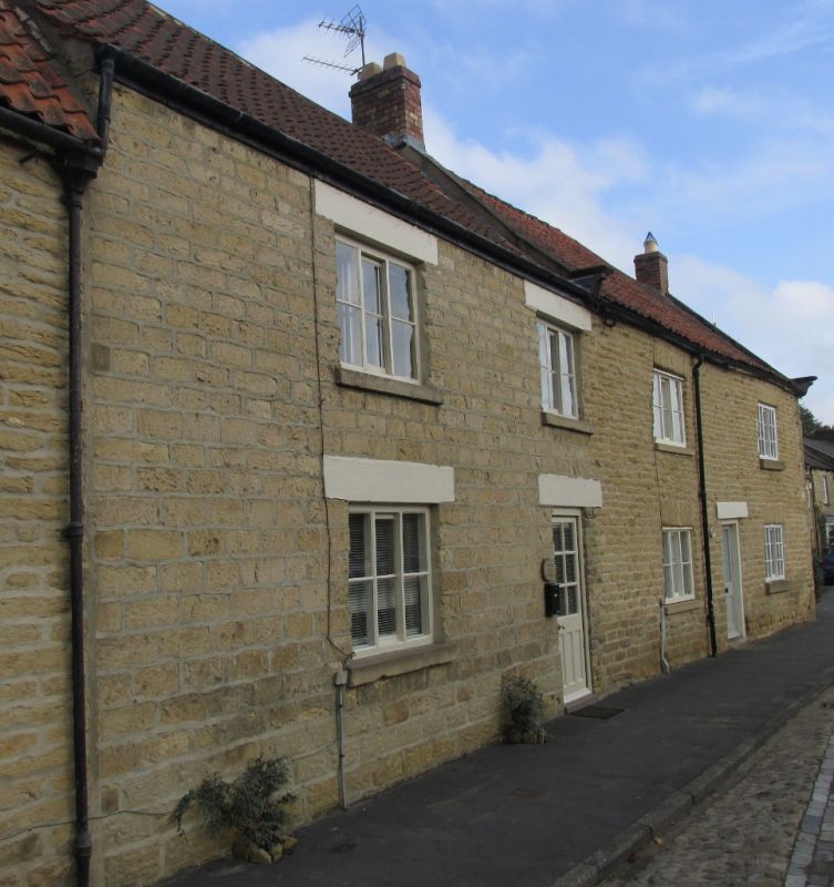
SE 6183 HELMSLEY HIGH STREET
(east side)
10/70 No 28
-
GV II
House. Late C18/early C19. Squared coursed sandstone rubble, pantile
roof, brick stacks. End-passage plan with entrance to right.
2 storeys, 2 first floor windows. C20 half-glazed door to right,
3-light Yorkshire sash to left. First floor: 3-light Yorkshire sashes,
all with stone sills and lintels. Swept roof with left gable end stack.
Included for group considerations.
Listing NGR: SE6106483995
External links are from the relevant listing authority and, where applicable, Wikidata. Wikidata IDs may be related buildings as well as this specific building. If you want to add or update a link, you will need to do so by editing the Wikidata entry.


Other nearby listed buildings
