Approximate Location Map
Large Map »
Latitude: 54.4016 / 54°24'5"N
Longitude: -1.7397 / 1°44'22"W
OS Eastings: 416995
OS Northings: 500716
OS Grid: NZ169007
Mapcode National: GBR JK9J.4X
Mapcode Global: WHC6D.7MTH
Plus Code: 9C6WC726+M4
Entry Name: 8, Cornforth Hill
Listing Date: 20 April 1967
Grade: II
Source: Historic England
Source ID: 1318413
English Heritage Legacy ID: 322931
ID on this website: 101318413
Location: Richmond, North Yorkshire, DL10
County: North Yorkshire
District: Richmondshire
Civil Parish: Richmond
Built-Up Area: Richmond
Traditional County: Yorkshire
Lieutenancy Area (Ceremonial County): North Yorkshire
Church of England Parish: Richmond with Holy Trinity with Hudswell
Church of England Diocese: Leeds
Tagged with: Building
This list entry was subject to a Minor Enhancement on 26 May 2021 to amend the description, update the name and address, and to reformat the text to current standards
NZ 1600 NE
5/253
CORNFORTH HILL (south side)
No 8
(Formerly listed as Nos 8 and 9)
20.4.67.
GV
II
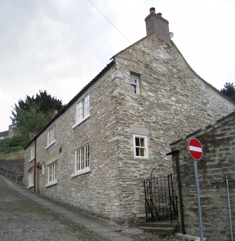
House, previously divided into cottages. C18, perhaps earlier.
MATERIALS: roughly coursed stone, pantile roof, brick stacks.
EXTERIOR: the main elevation faces north and is of three wide bays and two storeys. The front door is positioned between the eastern two bays, a small inserted window being placed to its right (west). The door is vertically boarded and set beneath a brick flat arch. All three bays have a broad window to each floor also with brick flat arches and projecting sills; the central ground floor window previously being narrower, now having a reconstituted stone lintel set beneath a residual brick arch. The joinery for these large windows consists of modern Yorkshire horizontal sliding sashes each of three lights of six panes, the flanking lights being fixed. The gables are raised and coped and have brick end stacks.
Listing NGR: NZ1699500716
External links are from the relevant listing authority and, where applicable, Wikidata. Wikidata IDs may be related buildings as well as this specific building. If you want to add or update a link, you will need to do so by editing the Wikidata entry.


Other nearby listed buildings
