Approximate Location Map
Large Map »
Latitude: 54.4054 / 54°24'19"N
Longitude: -1.7343 / 1°44'3"W
OS Eastings: 417346
OS Northings: 501133
OS Grid: NZ173011
Mapcode National: GBR JKBH.BK
Mapcode Global: WHC6D.BJDM
Plus Code: 9C6WC748+47
Entry Name: 63, Frenchgate
Listing Date: 20 April 1967
Grade: II
Source: Historic England
Source ID: 1318421
English Heritage Legacy ID: 322968
ID on this website: 101318421
Location: Richmond, North Yorkshire, DL10
County: North Yorkshire
District: Richmondshire
Civil Parish: Richmond
Built-Up Area: Richmond
Traditional County: Yorkshire
Lieutenancy Area (Ceremonial County): North Yorkshire
Church of England Parish: Richmond with Holy Trinity with Hudswell
Church of England Diocese: Leeds
Tagged with: Building
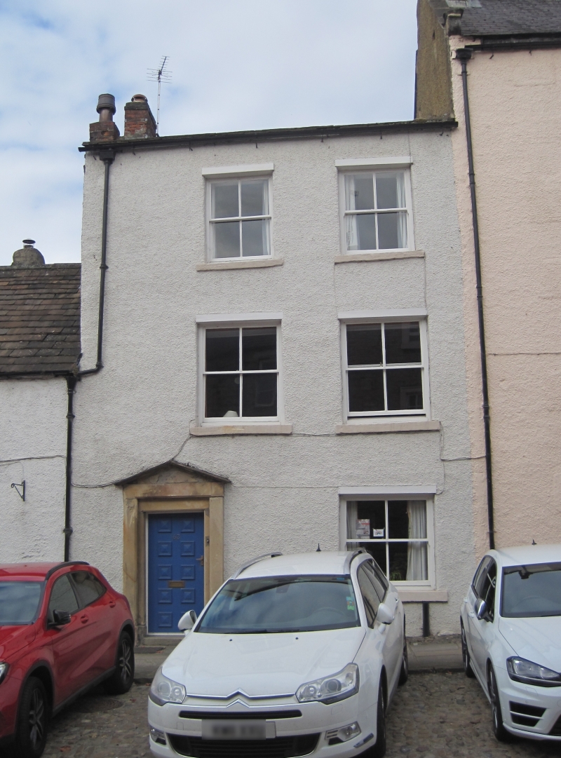
1. FRENCHGATE
1549 (West Side)
No 63
NZ 1701 SW 3/79 20.4.67.
II GV
2.
Mid C18. Three storeys, rough rendered. Stone slate roof. Plinth.
Two windows, later glazing. Four-panel door in plain stone surround with
hood forming pediment.
Nos 59 to 75 (odd) and Nos 79 to 83 (odd) form a group
Listing NGR: NZ1734601133
External links are from the relevant listing authority and, where applicable, Wikidata. Wikidata IDs may be related buildings as well as this specific building. If you want to add or update a link, you will need to do so by editing the Wikidata entry.


Other nearby listed buildings
