Approximate Location Map
Large Map »
Latitude: 51.4117 / 51°24'42"N
Longitude: -0.8322 / 0°49'56"W
OS Eastings: 481311
OS Northings: 168723
OS Grid: SU813687
Mapcode National: GBR D7R.DFF
Mapcode Global: VHDX2.JSD4
Plus Code: 9C3XC569+M4
Entry Name: 36 and 38, Rose Street
Listing Date: 2 October 1969
Grade: II
Source: Historic England
Source ID: 1319154
English Heritage Legacy ID: 41727
ID on this website: 101319154
Location: Wokingham, Berkshire, RG40
County: Wokingham
Civil Parish: Wokingham
Built-Up Area: Wokingham
Traditional County: Berkshire
Lieutenancy Area (Ceremonial County): Berkshire
Church of England Parish: Wokingham
Church of England Diocese: Oxford
Tagged with: Building
WOKINGHAM ROSE STREET
SU 8168 NW
(North west side)
18/46 Nos. 36 and 38
2.10.69
G.V. II
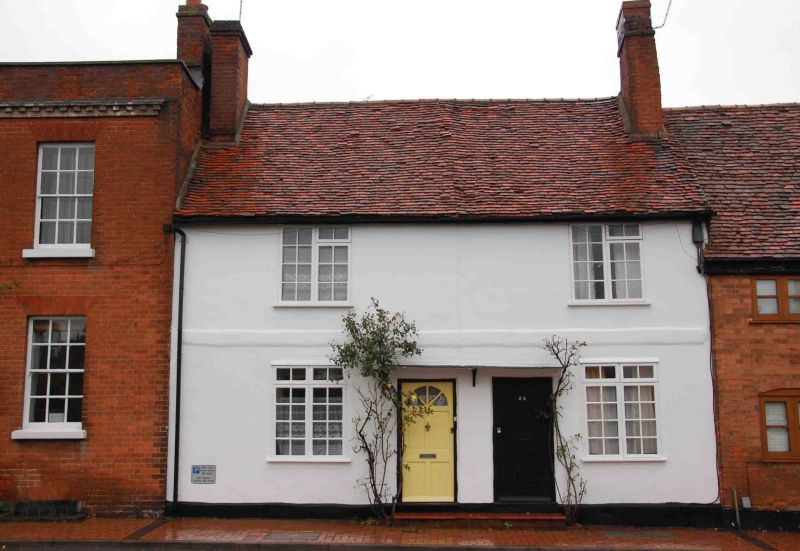
Pair of houses. Early C17 altered C20. Part timber framed rendered and
painted, part brick; old tile gabled roof. U-plan, 2 gables at rear,
with flat roof C20 extension between. 2 storeys. Flanking chimneys. 2
bays. C20 2-light casement windows with glazing bars and 2, C20 entrance
doors in centre.
Listing NGR: SU8131168723
External links are from the relevant listing authority and, where applicable, Wikidata. Wikidata IDs may be related buildings as well as this specific building. If you want to add or update a link, you will need to do so by editing the Wikidata entry.


Other nearby listed buildings
