Approximate Location Map
Large Map »
Latitude: 51.4101 / 51°24'36"N
Longitude: -0.8344 / 0°50'4"W
OS Eastings: 481160
OS Northings: 168546
OS Grid: SU811685
Mapcode National: GBR C6D.KV1
Mapcode Global: VHDX2.HT6C
Plus Code: 9C3XC568+36
Entry Name: Fosters
Listing Date: 12 November 1951
Grade: II
Source: Historic England
Source ID: 1319186
English Heritage Legacy ID: 41694
ID on this website: 101319186
Location: Wokingham, Berkshire, RG40
County: Wokingham
Civil Parish: Wokingham
Built-Up Area: Wokingham
Traditional County: Berkshire
Lieutenancy Area (Ceremonial County): Berkshire
Church of England Parish: Wokingham St Paul
Church of England Diocese: Oxford
Tagged with: Building
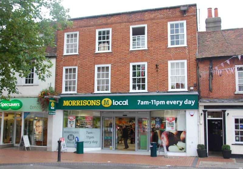
WOKINGHAM MARKET PLACE
SU 8168 NW
(West side)
18/36 Nos. 9 & 10 (Fosters)
12.11.51
G.V. II
Town house, now shop and offices. Late C18, altered mid C20. Brick.
Open plan ground floor. 3 storeys. Parapet. 4 bay front, sash windows
with glazing bars. Ground floor has large C20 shopfront of no special
interest. Included for group value.
Listing NGR: SU8116068546
External links are from the relevant listing authority and, where applicable, Wikidata. Wikidata IDs may be related buildings as well as this specific building. If you want to add or update a link, you will need to do so by editing the Wikidata entry.


Other nearby listed buildings
