Approximate Location Map
Large Map »
Latitude: 51.3986 / 51°23'54"N
Longitude: -1.1201 / 1°7'12"W
OS Eastings: 461307
OS Northings: 166982
OS Grid: SU613669
Mapcode National: GBR 93K.CM0
Mapcode Global: VHCZN.J3PP
Plus Code: 9C3W9VXH+CX
Entry Name: Millbrook
Listing Date: 10 November 1983
Grade: II
Source: Historic England
Source ID: 1319496
English Heritage Legacy ID: 39596
ID on this website: 101319496
Location: Padworth, West Berkshire, RG7
County: West Berkshire
Civil Parish: Padworth
Traditional County: Berkshire
Lieutenancy Area (Ceremonial County): Berkshire
Church of England Parish: Padworth
Church of England Diocese: Oxford
Tagged with: Building
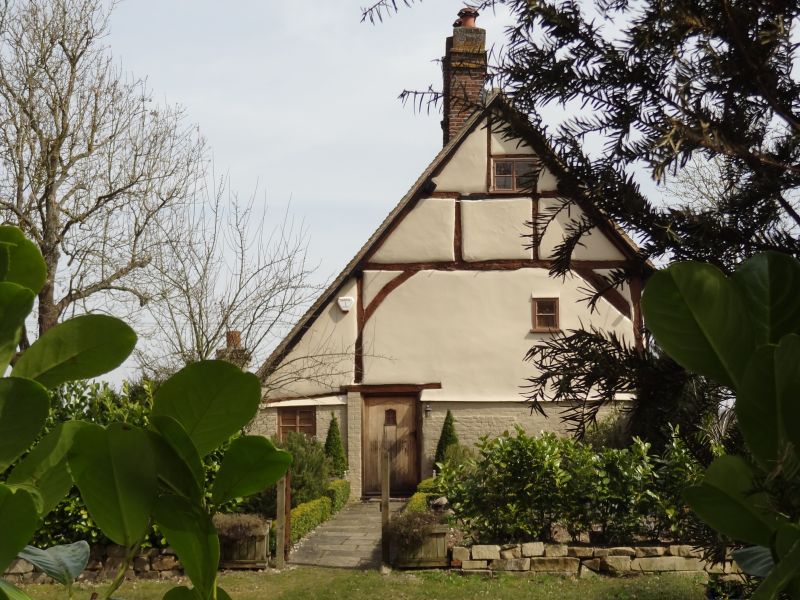
PADWORTH
SU 66 NW
4/4 Millbrook
- II
Cottage. Mid C16 with C17 addition to north-east. Timber framed with brick
and rendered facing; old tile roof with outshot to north-west, and end ridge
stack to south-west. 2 framed bays. 2 storeys and garret. South-east front;
2 C19 casements on each floor. Entrance to south-west.
Listing NGR: SU6130766982
External links are from the relevant listing authority and, where applicable, Wikidata. Wikidata IDs may be related buildings as well as this specific building. If you want to add or update a link, you will need to do so by editing the Wikidata entry.


Other nearby listed buildings
