Approximate Location Map
Large Map »
Latitude: 51.382 / 51°22'55"N
Longitude: -1.1522 / 1°9'8"W
OS Eastings: 459095
OS Northings: 165110
OS Grid: SU590651
Mapcode National: GBR 93Q.9HY
Mapcode Global: VHCZM.ZJ7F
Plus Code: 9C3W9RJX+Q4
Entry Name: 40, the Street
Listing Date: 14 April 1967
Grade: II
Source: Historic England
Source ID: 1319503
English Heritage Legacy ID: 39528
ID on this website: 101319503
Location: Aldermaston, West Berkshire, RG7
County: West Berkshire
Civil Parish: Aldermaston
Traditional County: Berkshire
Lieutenancy Area (Ceremonial County): Berkshire
Church of England Parish: Aldermaston
Church of England Diocese: Oxford
Tagged with: Building
SU 5965
10/22
14.4.67
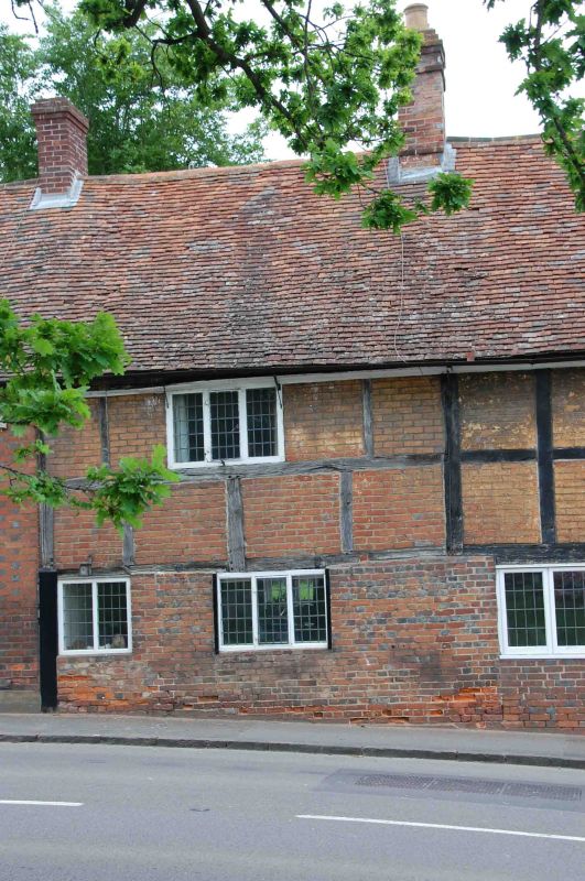
ALDERMASTON
THE STREET (west side)
No. 40
GV
II
Cottage. C17. Timber framed with brick nogging; moulded timber eaves to old
tile roof and end stack to right. 2 storeys. One 3-light leaded casement on
each floor, half glazed door to left.
Listing NGR: SU5909565110
External links are from the relevant listing authority and, where applicable, Wikidata. Wikidata IDs may be related buildings as well as this specific building. If you want to add or update a link, you will need to do so by editing the Wikidata entry.


Other nearby listed buildings
