Approximate Location Map
Large Map »
Latitude: 51.3789 / 51°22'44"N
Longitude: -1.1996 / 1°11'58"W
OS Eastings: 455802
OS Northings: 164733
OS Grid: SU558647
Mapcode National: GBR 93N.HK0
Mapcode Global: VHCZM.5L5S
Plus Code: 9C3W9RH2+H5
Entry Name: Elmet House
Listing Date: 10 November 1983
Grade: II
Source: Historic England
Source ID: 1319532
English Heritage Legacy ID: 39566
ID on this website: 101319532
Location: Brimpton, West Berkshire, RG7
County: West Berkshire
Civil Parish: Brimpton
Built-Up Area: Brimpton
Traditional County: Berkshire
Lieutenancy Area (Ceremonial County): Berkshire
Church of England Parish: Brimpton
Church of England Diocese: Oxford
Tagged with: House
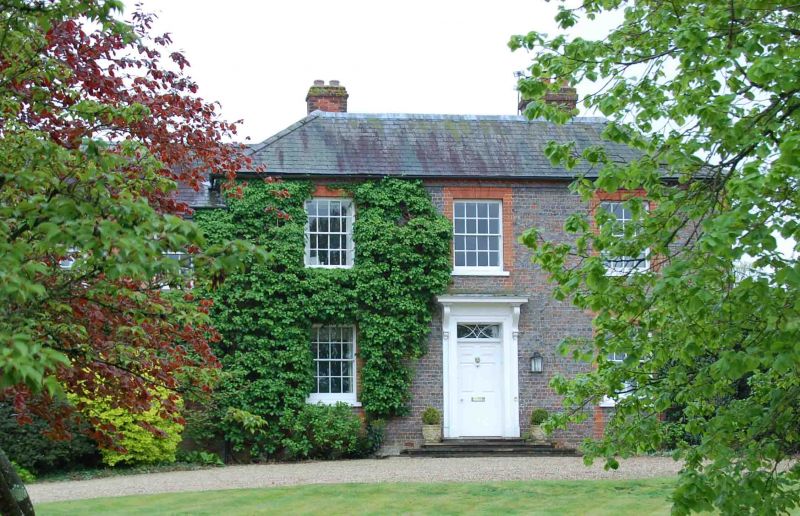
BRIMPTON
SU 56SE
6/3 Elmet House
- II
House. Early C19. Grey brick with red dressings and hipped slate roof with 2
stacks. 2 storeys; 3 bays, glazing bar sashes. Central 6 panelled door with
rectangular fanlight, architrave and scrolled bracket supporting flat hood. 2
storey, 3 bay later addition to left.
Listing NGR: SU5580264733
External links are from the relevant listing authority and, where applicable, Wikidata. Wikidata IDs may be related buildings as well as this specific building. If you want to add or update a link, you will need to do so by editing the Wikidata entry.


Other nearby listed buildings
