Approximate Location Map
Large Map »
Latitude: 52.0312 / 52°1'52"N
Longitude: -2.1148 / 2°6'53"W
OS Eastings: 392219
OS Northings: 236988
OS Grid: SO922369
Mapcode National: GBR 2KK.L4L
Mapcode Global: VH93N.96BP
Plus Code: 9C4V2VJP+F3
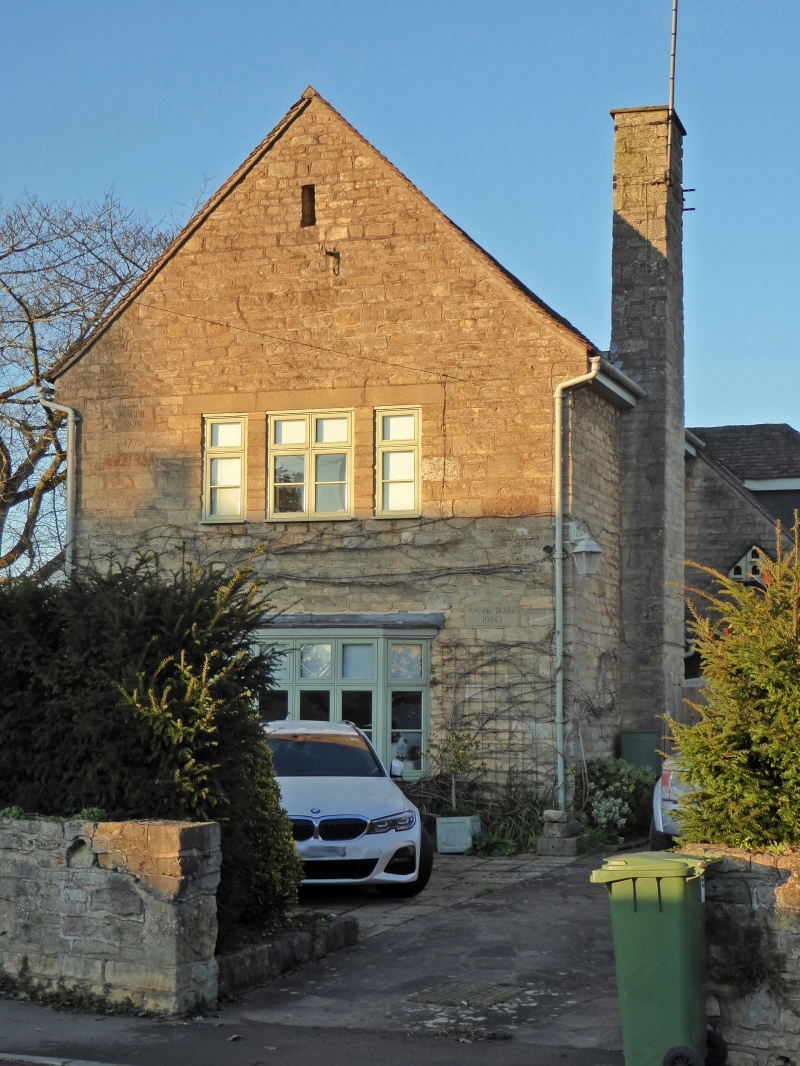
Entry Name: Magpie House
Listing Date: 3 August 1972
Grade: II
Source: Historic England
Source ID: 1319645
English Heritage Legacy ID: 442281
ID on this website: 101319645
Location: Bredon, Wychavon, Worcestershire, GL20
County: Worcestershire
District: Wychavon
Civil Parish: Bredon
Built-Up Area: Bredon
Traditional County: Worcestershire
Lieutenancy Area (Ceremonial County): Worcestershire
Church of England Parish: Bredon
Church of England Diocese: Worcester
Tagged with: House Thatched cottage
BREDON BREDON
1.
2301
Church Street
(North Side)
Magpie House
SO 9236 25/106
II
2.
C17/18 plain stone range of cottage dwellings, now one dwelling. Tile
roof. Casements. 2-storeys. End cottage has timber framing and thatched
roof. Group value.
Listing NGR: SO9221936988
External links are from the relevant listing authority and, where applicable, Wikidata. Wikidata IDs may be related buildings as well as this specific building. If you want to add or update a link, you will need to do so by editing the Wikidata entry.


Other nearby listed buildings
