Approximate Location Map
Large Map »
Latitude: 51.281 / 51°16'51"N
Longitude: 1.0765 / 1°4'35"E
OS Eastings: 614649
OS Northings: 158036
OS Grid: TR146580
Mapcode National: GBR TY2.NYV
Mapcode Global: VHLGM.L2Y9
Plus Code: 9F3373JG+CH
Entry Name: 38, St Peter's Street
Listing Date: 7 September 1973
Grade: II
Source: Historic England
Source ID: 1319842
English Heritage Legacy ID: 442968
ID on this website: 101319842
Location: Canterbury, Kent, CT1
County: Kent
District: Canterbury
Electoral Ward/Division: Westgate
Parish: Non Civil Parish
Built-Up Area: Canterbury
Traditional County: Kent
Lieutenancy Area (Ceremonial County): Kent
Tagged with: Building
1.
944 ST PETER'S STREET
(South West Side)
No 38
TR 1458 SE 2/307
II GV
2.
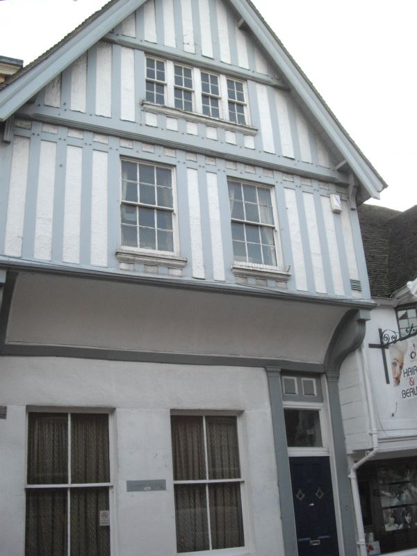
A C15 timber-framed building refaced about 1900. 2 storeys and attics timber-framed
with plaster infill. 2 sashes with moulded cills on 1sr floor. Coved overhang
to ground floor. Right side elongated doorcase has a 4 panelled door and
high fanlight. The rear elevation has a gable and old tiled roof.
Nos 34 to 39 (consec) form a group.
Listing NGR: TR1464958036
External links are from the relevant listing authority and, where applicable, Wikidata. Wikidata IDs may be related buildings as well as this specific building. If you want to add or update a link, you will need to do so by editing the Wikidata entry.


Other nearby listed buildings
