Approximate Location Map
Large Map »
Latitude: 54.9725 / 54°58'21"N
Longitude: -1.6163 / 1°36'58"W
OS Eastings: 424660
OS Northings: 564278
OS Grid: NZ246642
Mapcode National: GBR SNW.6K
Mapcode Global: WHC3R.48LV
Plus Code: 9C6WX9FM+2F
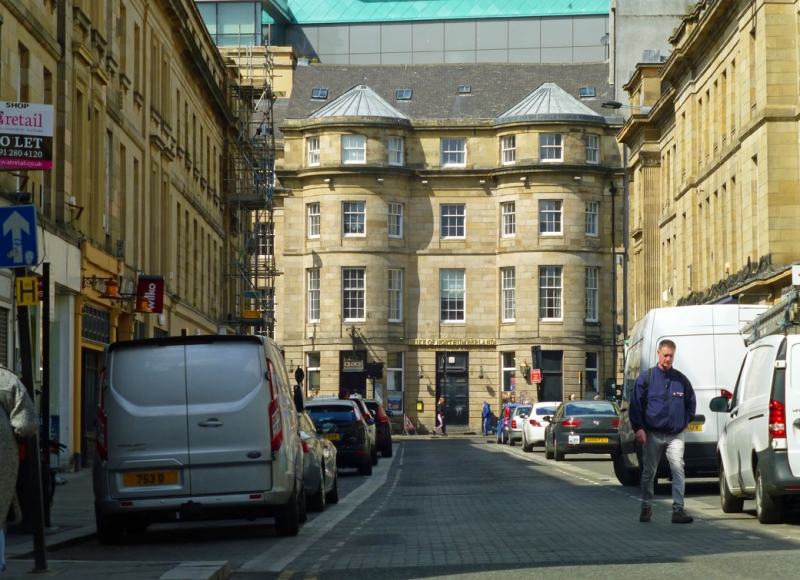
Entry Name: Duke of Northumberland Public House
Listing Date: 12 November 1965
Grade: II
Source: Historic England
Source ID: 1320107
English Heritage Legacy ID: 304477
ID on this website: 101320107
Location: Newcastle Helix, Newcastle upon Tyne, Tyne and Wear, NE1
County: Newcastle upon Tyne
Electoral Ward/Division: Westgate
Parish: Non Civil Parish
Built-Up Area: Newcastle upon Tyne
Traditional County: Northumberland
Lieutenancy Area (Ceremonial County): Tyne and Wear
Church of England Parish: Newcastle St Andrew
Church of England Diocese: Newcastle
Tagged with: Pub
NZ 2464 SE NEWCASTLE UPON TYNE CLAYTON STREET
(west side)
20/170 No.18 (Duke of
12/11/65 Northumberland P.H.)
G.V. II
Public house. Circa 1837, probably by John Wardle, for Richard Grainger. Sand-
stone ashlar; roof of concrete tiles. 4 storeys, 7 windows, the outer 3 at
either side in semicircular bowed projections. Central double 8-panelled door
and overlight; and doors with beaded panels, also with overlights, in side bays;
plain reveals to these and to sash windows, most with glazing bars, on upper floors;
renewed on ground floor. Floor bands and second-floor prominent cornice. Top
cornice.
Listing NGR: NZ2466064277
External links are from the relevant listing authority and, where applicable, Wikidata. Wikidata IDs may be related buildings as well as this specific building. If you want to add or update a link, you will need to do so by editing the Wikidata entry.


Other nearby listed buildings
