Approximate Location Map
Large Map »
Latitude: 51.5384 / 51°32'18"N
Longitude: -2.3928 / 2°23'34"W
OS Eastings: 372852
OS Northings: 182242
OS Grid: ST728822
Mapcode National: GBR 0NJ.FVX
Mapcode Global: VH95T.GLWH
Plus Code: 9C3VGJQ4+9V
Entry Name: 67, Broad Street
Listing Date: 29 July 1983
Grade: II
Source: Historic England
Source ID: 1320894
English Heritage Legacy ID: 34068
ID on this website: 101320894
Location: Chipping Sodbury, South Gloucestershire, BS37
County: South Gloucestershire
Civil Parish: Sodbury
Built-Up Area: Chipping Sodbury
Traditional County: Gloucestershire
Lieutenancy Area (Ceremonial County): Gloucestershire
Church of England Parish: Chipping Sodbury St John the Baptist
Church of England Diocese: Gloucester
Tagged with: Building
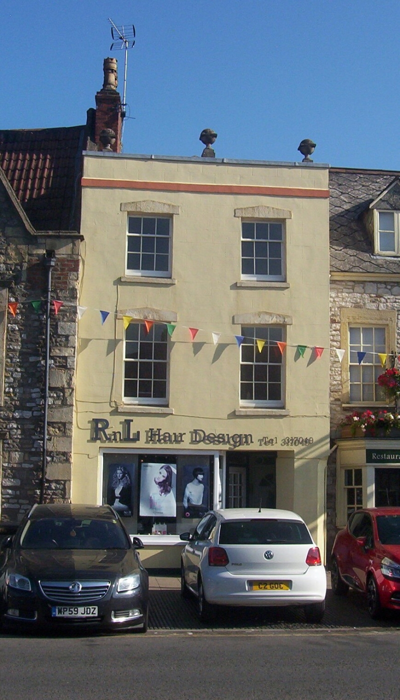
ST 7282 SE SODBURY BROAD STREET
5/21 (north side)
No 67
GV
II
Early C19. Rendered brick. Roof concealed behind parapet with 3 spherical finials.
Three storeys. Two windows, glazing bar sashes. Modern shopfront.
Listing NGR: ST7285282251
External links are from the relevant listing authority and, where applicable, Wikidata. Wikidata IDs may be related buildings as well as this specific building. If you want to add or update a link, you will need to do so by editing the Wikidata entry.


Other nearby listed buildings
