Approximate Location Map
Large Map »
Latitude: 51.9457 / 51°56'44"N
Longitude: -0.4444 / 0°26'39"W
OS Eastings: 507015
OS Northings: 228604
OS Grid: TL070286
Mapcode National: GBR G4B.VX7
Mapcode Global: VHFR7.7CW9
Plus Code: 9C3XWHW4+76
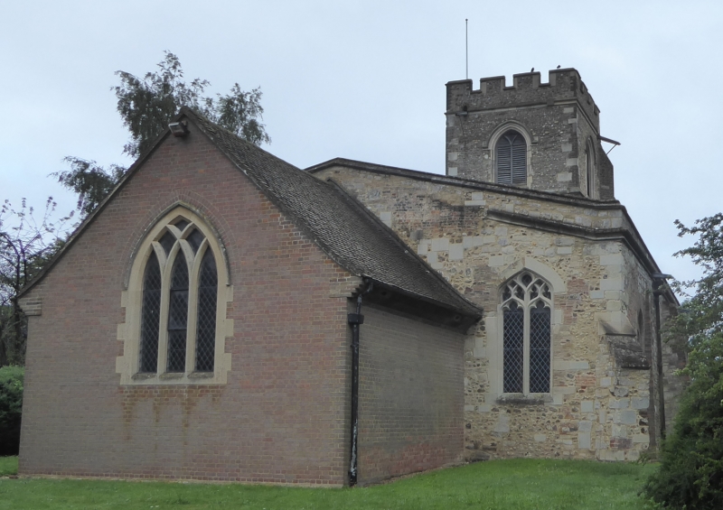
Entry Name: Church of St Margaret
Listing Date: 3 February 1967
Grade: I
Source: Historic England
Source ID: 1321310
English Heritage Legacy ID: 36078
ID on this website: 101321310
Location: St Margarets Church, Streatley, Central Bedfordshire, LU3
County: Central Bedfordshire
Civil Parish: Streatley
Built-Up Area: Streatley
Traditional County: Bedfordshire
Lieutenancy Area (Ceremonial County): Bedfordshire
Church of England Parish: Streatley
Church of England Diocese: St.Albans
Tagged with: Church building
1.
5125 STREATHLEY SHARPENHOE ROAD
(west side)
Church of St Margaret
TL 02 NE 23/278 3.2.67
I
2.
C14 nave with 4 bay arcade. North doorway and east and west aisle windows are
of the same date. C15 west tower. Late C19 brick chancel. Fine C13 font-octagonal
bowl-has foliage or tracery panels on each face; base of 4 engaged shafts with
moulded bases and capitals.
Listing NGR: TL0701528604
External links are from the relevant listing authority and, where applicable, Wikidata. Wikidata IDs may be related buildings as well as this specific building. If you want to add or update a link, you will need to do so by editing the Wikidata entry.


Other nearby listed buildings
