Approximate Location Map
Large Map »
Latitude: 51.8846 / 51°53'4"N
Longitude: -0.5243 / 0°31'27"W
OS Eastings: 501667
OS Northings: 221705
OS Grid: TL016217
Mapcode National: GBR G50.SBG
Mapcode Global: VHFRC.VWQL
Plus Code: 9C3XVFMG+V7
Entry Name: 7, Icknield Street
Listing Date: 4 March 1976
Grade: II
Source: Historic England
Source ID: 1321360
English Heritage Legacy ID: 35766
ID on this website: 101321360
Location: Dunstable, Central Bedfordshire, LU6
County: Central Bedfordshire
Civil Parish: Dunstable
Built-Up Area: Dunstable
Traditional County: Bedfordshire
Lieutenancy Area (Ceremonial County): Bedfordshire
Church of England Parish: Dunstable
Church of England Diocese: St.Albans
Tagged with: Building
1.
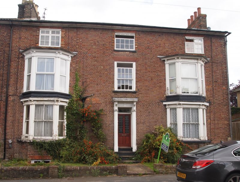
5125 ICKNIELD STREET
No 7
TL 0121 NE 1/112
II GV
2.
Mid C19. Brown brick, Welsh slates, cornice. Basement and 3 storeys, 2 canted
2 storey bay windows. Central door in surround with slim pilasters, console brackets,
cornice hood. Included for group value.
Nos 1 to 7 (odd) form a group.
Listing NGR: TL0166721705
External links are from the relevant listing authority and, where applicable, Wikidata. Wikidata IDs may be related buildings as well as this specific building. If you want to add or update a link, you will need to do so by editing the Wikidata entry.


Other nearby listed buildings
