Approximate Location Map
Large Map »
Latitude: 52.1348 / 52°8'5"N
Longitude: -0.4679 / 0°28'4"W
OS Eastings: 504959
OS Northings: 249604
OS Grid: TL049496
Mapcode National: GBR G25.2J2
Mapcode Global: VHFQ7.VL0V
Plus Code: 9C4X4GMJ+WR
Entry Name: 7a St Paul's Square and Cowper Building
Listing Date: 14 May 1971
Last Amended: 11 May 2023
Grade: II
Source: Historic England
Source ID: 1321438
English Heritage Legacy ID: 35564
ID on this website: 101321438
Location: Bedford, Bedfordshire, MK40
County: Bedford
Electoral Ward/Division: Castle
Parish: Non Civil Parish
Built-Up Area: Bedford
Traditional County: Bedfordshire
Lieutenancy Area (Ceremonial County): Bedfordshire
Church of England Parish: Bedford St Paul
Church of England Diocese: St.Albans
Tagged with: Building
Former school building, built between 1884 and 1886 to designs by Basil Champneys, extended in 1899 to designs by Henry Young, with an attached former school gymnasium built around 1880.
Former school building, built between 1884 and 1886 to designs by Basil Champneys, extended in 1899 to designs by Henry Young, with an attached former school gymnasium built around 1880.
MATERIALS: The north building, 7a St Paul’s Square, has ashlar sandstone walls and dressings and a pantile roof covering. The south building, the Cowper Building, is constructed of red brick with sandstone dressings and has a slate roof covering. The former gymnasium to the east of the Cowper Building is constructed of brick with a pantile roof covering.
PLAN: 7a St Paul’s Square is roughly rectangular on plan with a shallow projection on its west side. The Cowper Building is roughly L-shaped on plan. The former gymnasium is rectangular on plan.
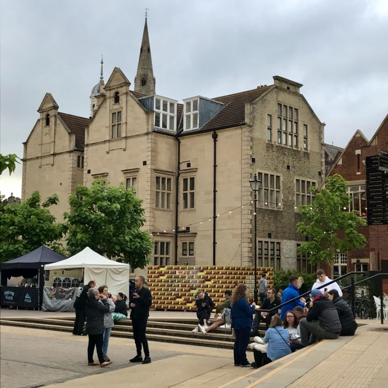
EXTERIOR: 7a St Paul’s Square, built between 1884 and 1886 to designs by Basil Champneys, is a two-and-half storey four-bay building fronting St Paul’s Square. The pitched roof has a pantile covering (likely replaced in the mid-C20), a cupola to the centre of its ridge, and two box dormers, each with a pediment, mullions and transoms. The building has four brick chimneystacks, mostly stuccoed to imitate sandstone and with plain entablatures, and the building also retains cast-iron rainwater goods. The walls are constructed of ashlar sandstone and have a plain cornice with a fine dentil course and rusticated quoins. Each of the elevations have rectangular latticed ventilation grilles above or to the side of windows. All windows have mullions and transoms and contain leaded lights unless otherwise stated. The ground- and first-floor windows are arranged in two pairs, each window having an architrave surround with a plain entablature and apron. The first-floor windows also feature a triangular pediment containing a cartouche, and a swag over. The side (west) elevation to Merchant Place has two gables, and the south gable projects slightly. Both gables feature a round-arched opening in an architrave surround and a triangular pediment to their apex, and their returns feature a box dormer and a single bay of windows. The north gable is blind, and the south gable has an attic window in an architrave surround, and two bays of windows to its ground and first floors. Between the two gables is a round-arched moulded door surround containing round-arched double-leaf half-glazed and panelled doors. South of the gabled projection, a single door was replaced by a fire door in a concrete surround in the late C20; a pair of windows survive over the door in an architrave surround. The south gable is constructed of gault brick laid in Flemish bond and features a substantial attic window of 16 lights and two bays of 8 light windows on each of the ground and first floors.
South of 7a St Paul’s Square and formerly connected at ground floor level, the Cowper Building is a two-storey former school building overlooking the river, built to designs by local architect Henry Young in 1899. The building has a long, pitched roof to the river, the east half has an additional two pitched roofs to the north, and the west half has an additional shallow-pitched roof to the north. All roofs are slate covered and gabled, with sandstone detailing. The building retains five red brick chimneystacks. The walls are constructed of red brick laid in Flemish bond with yellow sandstone dressings. Generally, the windows throughout the Cowper Building have a timber mullion and transom, multi-paned bottom-hung casements to their upper sections, and two lights to their lower sections, unless otherwise stated. The south elevation facing the river has a shallow gabled projection on its west side, with three first-floor windows, a hood moulding over the central window, and five ground-floor windows. To the east are two full-height canted bays, each having a scrolled sandstone finial to their parapet. The west elevation to Merchant Place steps back in three gabled sections. The longest section fronting the river has five first-floor windows and a ground-floor entrance introduced in place of three windows around 2014. The north elevation of the west part has three bays and features a central sandstone door surround with a flat canopy on brackets, a rectangular glazed overlight, and flat-arched double-leaf glazed doors. The west elevation of the rear projection has three windows and a door to the ground floor, and large metal-framed windows to the first floor, likely replaced in the early C20. The north elevation of the rear projection has two ground-floor windows, a blocked door opening and an early-C20 metal framed window beyond. Attached to the east side of the Cowper Building is a former school gymnasium, probably built around 1880. Constructed of brick, it is gabled to the riverside, with a pantile roof covering, blocked bullseye window to the gable, and two storeys of flat-arched windows which replaced two tall round-arched windows around 2017.
INTERIOR: 7a St Paul’s Square has three large former school rooms to the north end, south end, and west side of its ground, first and second floors; internal partitions were introduced in some of these rooms in the late C20. Generally, the former school rooms retain six-panel doors in architrave surrounds, cornices, dado rails and some picture rails. All fireplaces have been removed and openings blocked. A long corridor runs north-south along the east side of the interior, with a straight stair rising southwards along the east wall. The stair has a right-hand volute over a twisted cast-iron newel post, wrought-iron stick balusters, and moulded wooden handrail rising from the volute with a swan neck. Two scrolled hooks are suspended from the east side of the balusters, possibly for lanterns. The left side of the stair has a twisted cast-iron newel post on the curved bottom step and is topped with a bun from which a handrail rises to the landing, suspended from the wall by brackets. A glazed partition and door were added to the east side of the landing in the late C20, resulting in the removal of some balusters. The stair rising from the first floor is identical. A high proportion of windows retain their original window furniture.
The interior of the Cowper Building was converted to hospitality use around 2014. The original U-shaped stone stair survives in the north-west corner of the building, and features a curved bottom step, right-hand volute over a twisted cast-iron newel post, and moulded wooden handrail over pairs of metal stick balusters. The interior has been remodelled for hospitality use, and no original fixtures or fittings survive. A glazed stair was introduced in the northwest corner of the rear projection around 2017. The interior of the former gymnasium building was converted to hospitality use in the early C21 and a first floor inserted.
Bedford lies in the shallow valley of the River Great Ouse, and from the Middle Saxon period, evidence appears for the beginnings of a settlement at ‘Beda’s ford’, a key river crossing point. The Middle Saxon core of Bedford developed on the north side of the river with an early street pattern (still recognisable) and was surrounded by a defensive ditch. In the C10 and C11, Bedford was important both as a trading centre, with coins minted in the town, and as the central burh of the shire. The town’s main north-south route, comprising what is now High Street to the north of the river and St Mary’s and St John’s Streets to the south of the river, was developed by this time. After 1066, Bedford became a stronghold of the new Norman regime and during the reign of William II, a motte and bailey castle was built in a strategic position on the north bank of the river and then rebuilt in stone. A period of unrest, however, led to a siege of the castle in 1224 and, when it fell, Henry III ordered it to be dismantled. Despite political struggles, the town experienced a period of consolidation during the Norman and medieval periods, when local commerce flourished and religious houses and hospitals were founded. The population of the town was decimated by the Black Death in the C14, and a new river crossing at Great Barford undermined the local economy by drawing traffic and trade away from the town. There was little further growth and the town was largely contained within its Saxon framework, as can be seen from John Speed’s map of Bedford dated 1610.
The dissolution of the monasteries under Henry VIII dealt a further blow to the town’s prosperity but its fortunes began to revive with the receipt of letters patent from Edward VI, allowing the foundation of a grammar school. Owing to the generosity of Sir William and Dame Alice Harpur and their foundation of The Harpur Trust, Bedford became a centre of educational excellence. The town also benefitted from the River Navigation Act, which made the River Great Ouse navigable between Bedford and King’s Lynn (completed in 1689). The town became the headquarters of Cromwell’s army between 1646 and 1647 and the Puritan influence established during the Civil War lived on after the Declaration of Indulgence in 1672, when the town became a centre for non-conformist preachers such as John Bunyan. Despite this prosperity, Bedford remained of modest size through to the end of the C18, as illustrated on Thomas Jefferys’ map of 1765. An Improvement Act in 1803 allowed for the erection of a new river bridge between 1811 and 1813 (widened in 1938), and clearance of the Market Square. Continuing prosperity in the early C19 was accompanied by modest growth, but by far the most dramatic expansion of Bedford followed the building of the Midland Railway in 1873, linking the town with London, and associated industrialisation.
The building which previously stood on the site of 7a St Paul’s Square is shown as a three-storey four-bay Georgian townhouse on Dawson’s panorama from the Church of St Paul in 1833; it was later shown on the 1884 Ordnance Survey map with three fives courts and a gymnasium building between it and the river to the south. 7a St Paul’s Square was constructed between 1884 and 1886 as an extension to the Grammar School (now Bedford Registry Office) and was designed by Basil Champneys (1842-1935), a leading architect of the Victorian period with a number of listed buildings to his name. Champneys’ wide range of designs included college buildings in Oxford and Cambridge, and his design of 7a St Paul’s Square bears some similarities to his designs of the recently completed Indian Institute in Oxford, and Bedford High School for Girls on Bromham Road, Bedford (both completed 1882 and listed at Grade II). 7a St Paul’s Square was formerly known as the Cowper Building, named after Francis Cowper (1834-1905), 7th Earl Cowper, who was Lord Lieutenant of Bedfordshire between 1861 and 1905.
The school building was taken on by the Bedford Girls' Modern School in 1891. A red brick school building was built to the south overlooking the river in 1899, designed by local architect Henry Young (1843-?) and is shown on the 1901 Ordnance Survey map. The riverfront building was soon extended to the west, probably also by Young and the extension is shown on the 1926 OS map; this early-C20 extension was later demolished and replaced by a new Town Hall (built in 1968 and demolished around 2014). The Girls’ Modern School outgrew the site and relocated to Cardington Road in 1938, after which the former school buildings were utilised as council offices. The building fronting St Paul’s Square became known as 7a St Paul’s Square, and the riverfront building became known as the Cowper Building.
7a St Paul’s Square and the Cowper Building are listed at Grade II for the following principal reasons:
Architectural interest:
* for the architectural quality of this group of educational buildings, which employ quality materials, elegant proportions and fine architectural detailing in their construction;
* for the design of 7a St Paul’s Square by Basil Champneys, an architect of national renown, with a number of listed educational buildings to his name.
Historic interest:
* for the role these former school buildings played in the history of education in Bedford, a historic centre of educational excellence from the mid-C16 onwards;
* for the contribution they make to the evolution of historic St Paul’s Square and development of the town.
Group value:
* for the historic and functional group they form with the neighbouring former Grammar School on St Paul’s Square, now the Town Hall (listed at Grade II).
External links are from the relevant listing authority and, where applicable, Wikidata. Wikidata IDs may be related buildings as well as this specific building. If you want to add or update a link, you will need to do so by editing the Wikidata entry.


Other nearby listed buildings
