Approximate Location Map
Large Map »
Latitude: 50.4322 / 50°25'55"N
Longitude: -3.69 / 3°41'23"W
OS Eastings: 280068
OS Northings: 60510
OS Grid: SX800605
Mapcode National: GBR QL.MCP1
Mapcode Global: FRA 375X.682
Plus Code: 9C2RC8J6+V2
Entry Name: 3, Castle Street
Listing Date: 16 March 1978
Grade: II
Source: Historic England
Source ID: 1325378
English Heritage Legacy ID: 99080
ID on this website: 101325378
Location: Totnes, South Hams, Devon, TQ9
County: Devon
District: South Hams
Civil Parish: Totnes
Built-Up Area: Totnes
Traditional County: Devon
Lieutenancy Area (Ceremonial County): Devon
Church of England Parish: Totnes St Mary
Church of England Diocese: Exeter
Tagged with: Building
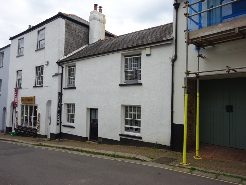
1.
5180 CASTLE STREET
(East Side)
-------------
No 3
SX 8060 NW 1/152
II GV
2.
Early Cl9. 2 storeys. 2 windows. Welsh slate roof with brick stacks. Rendered
front. Recessed sash windows with glazing bars. Recessed doorway with ½ glazed
door.
Listing NGR: SX8006860510
External links are from the relevant listing authority and, where applicable, Wikidata. Wikidata IDs may be related buildings as well as this specific building. If you want to add or update a link, you will need to do so by editing the Wikidata entry.


Other nearby listed buildings
