Approximate Location Map
Large Map »
Latitude: 54.3897 / 54°23'22"N
Longitude: -3.0575 / 3°3'27"W
OS Eastings: 331424
OS Northings: 499867
OS Grid: SD314998
Mapcode National: GBR 7K2P.V6
Mapcode Global: WH82C.0X9P
Plus Code: 9C6R9WQR+VX
Entry Name: Shepherd's Bridge
Listing Date: 22 September 1987
Grade: II
Source: Historic England
Source ID: 1325971
English Heritage Legacy ID: 76765
ID on this website: 101325971
Location: Westmorland and Furness, Cumbria, LA21
County: Cumbria
District: South Lakeland
Civil Parish: Coniston
Traditional County: Lancashire
Lieutenancy Area (Ceremonial County): Cumbria
Church of England Parish: Coniston and Torver
Church of England Diocese: Carlisle
Tagged with: Bridge
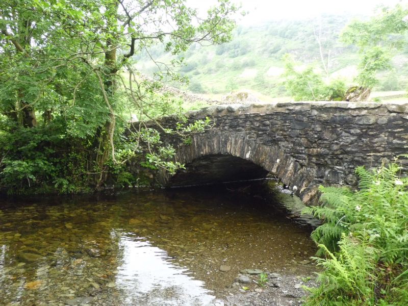
CONISTON
SD 39 NW
5/59 Shepherd's Bridge
II
Bridge. Date uncertain, probably C18. Stone rubble. Segmental arch and plain
parapet. Bridge widened.
Listing NGR: SD3142499867
External links are from the relevant listing authority and, where applicable, Wikidata. Wikidata IDs may be related buildings as well as this specific building. If you want to add or update a link, you will need to do so by editing the Wikidata entry.


Other nearby listed buildings
