Approximate Location Map
Large Map »
Latitude: 51.1585 / 51°9'30"N
Longitude: 0.6649 / 0°39'53"E
OS Eastings: 586442
OS Northings: 143293
OS Grid: TQ864432
Mapcode National: GBR QV3.6Y3
Mapcode Global: VHJN2.G4VQ
Plus Code: 9F325M57+CW
Entry Name: Munk's Farmhouse
Listing Date: 10 October 1980
Grade: II
Source: Historic England
Source ID: 1325984
English Heritage Legacy ID: 181172
ID on this website: 101325984
Location: Smarden Bell, Ashford, Kent, TN27
County: Kent
District: Ashford
Civil Parish: Smarden
Traditional County: Kent
Lieutenancy Area (Ceremonial County): Kent
Tagged with: Farmhouse
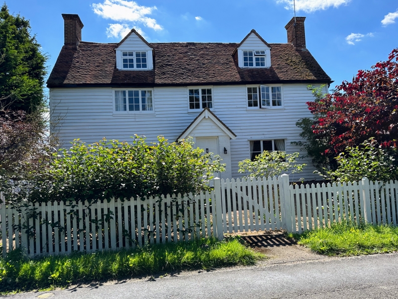
1.
5272 SMARDEN BELL ROAD
Munk's Farmhouse
TQ 84 SE 13/64
II
2.
C18. Two storeys and attics faced with weatherboarding. Tiled roof with 2
hipped d ormers. Three casement windows. C19 gabled red brick porch.
Listing NGR: TQ8665643248
External links are from the relevant listing authority and, where applicable, Wikidata. Wikidata IDs may be related buildings as well as this specific building. If you want to add or update a link, you will need to do so by editing the Wikidata entry.


Other nearby listed buildings
