Approximate Location Map
Large Map »
Latitude: 50.4908 / 50°29'26"N
Longitude: -4.0304 / 4°1'49"W
OS Eastings: 256074
OS Northings: 67630
OS Grid: SX560676
Mapcode National: GBR Q1.SGL8
Mapcode Global: FRA 27FR.RN6
Plus Code: 9C2QFXR9+8V
Entry Name: Holy Well of St Leonard
Listing Date: 28 October 1987
Grade: II
Source: Historic England
Source ID: 1326392
English Heritage Legacy ID: 92846
ID on this website: 101326392
Location: Sheepstor, West Devon, PL20
County: Devon
District: West Devon
Civil Parish: Sheepstor
Traditional County: Devon
Lieutenancy Area (Ceremonial County): Devon
Tagged with: Holy well
SHEEPSTOR SHEEPSTOR
SX 56 NE
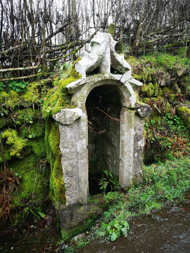
18/114 Holy well of St.Leonard
-
GV II
Holy well. Medieval. Granite rubble walls and roof enclosing well. Chamfered
arched opening has pierced gable above. Probably re-using tracery from Church
windows.
Listing NGR: SX5607567644
External links are from the relevant listing authority and, where applicable, Wikidata. Wikidata IDs may be related buildings as well as this specific building. If you want to add or update a link, you will need to do so by editing the Wikidata entry.


Other nearby listed buildings
