Approximate Location Map
Large Map »
Latitude: 54.7791 / 54°46'44"N
Longitude: -2.9084 / 2°54'30"W
OS Eastings: 341666
OS Northings: 543062
OS Grid: NY416430
Mapcode National: GBR 8F45.4M
Mapcode Global: WH80P.948M
Plus Code: 9C6VQ3HR+JJ
Entry Name: Wharton Bridge
Listing Date: 24 October 1986
Grade: II
Source: Historic England
Source ID: 1326713
English Heritage Legacy ID: 73975
ID on this website: 101326713
Location: Ivegill, Westmorland and Furness, Cumbria, CA4
County: Cumbria
District: Eden
Civil Parish: Skelton
Traditional County: Cumberland
Lieutenancy Area (Ceremonial County): Cumbria
Church of England Parish: Ivegill Christ Church
Church of England Diocese: Carlisle
Tagged with: Bridge
NY 44 SW SKELTON IVEGILL
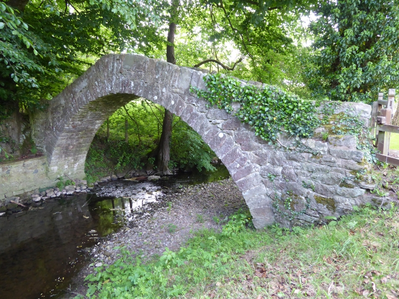
5/241 Wharton Bridge
II
Packhorse bridge now footbridge. Probably early C18. Mixed sandstone rubble.
Narrow humped-back bridge of single-span arch under solid irregular rubble
parapet.
Listing NGR: NY4166643062
External links are from the relevant listing authority and, where applicable, Wikidata. Wikidata IDs may be related buildings as well as this specific building. If you want to add or update a link, you will need to do so by editing the Wikidata entry.


Other nearby listed buildings
