Approximate Location Map
Large Map »
Latitude: 54.511 / 54°30'39"N
Longitude: -2.4983 / 2°29'53"W
OS Eastings: 367837
OS Northings: 512974
OS Grid: NY678129
Mapcode National: GBR BJZ8.XP
Mapcode Global: WH935.LWK4
Plus Code: 9C6VGG62+CM
Entry Name: Footbridge over Dale Beck West of Roadbridge
Listing Date: 12 April 1984
Grade: II
Source: Historic England
Source ID: 1326997
English Heritage Legacy ID: 73252
ID on this website: 101326997
Location: Great Asby, Westmorland and Furness, Cumbria, CA16
County: Cumbria
District: Eden
Town: Eden
Civil Parish: Asby
Traditional County: Westmorland
Lieutenancy Area (Ceremonial County): Cumbria
Church of England Parish: Asby St Peter
Church of England Diocese: Carlisle
Tagged with: Footbridge
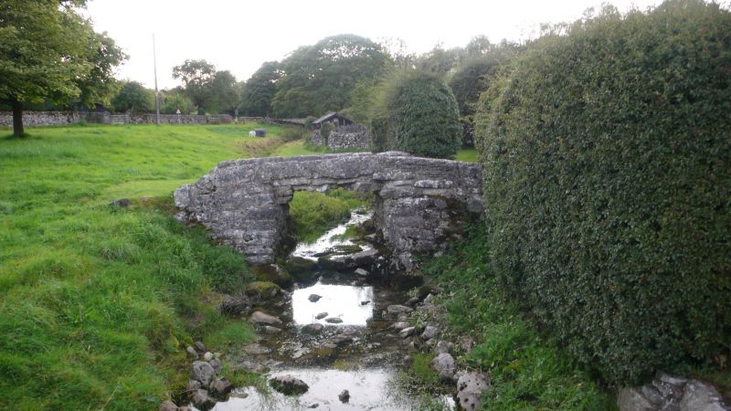
NY 61SE ASBY GREAT ASBY
11/13 Footbridge over Dale
Beck to west of
roadbridge
II
Footbridge, mid C19 (shown as ford on 1840 tithe map). Large stone slab spans
between 2 substantial abutments. Low parapets of large, roughly dressed,
stones. Footpath is 2 to 3 feet wide.
Listing NGR: NY6783712974
External links are from the relevant listing authority and, where applicable, Wikidata. Wikidata IDs may be related buildings as well as this specific building. If you want to add or update a link, you will need to do so by editing the Wikidata entry.


Other nearby listed buildings
