Approximate Location Map
Large Map »
Latitude: 50.19 / 50°11'23"N
Longitude: -5.1594 / 5°9'33"W
OS Eastings: 174579
OS Northings: 36995
OS Grid: SW745369
Mapcode National: GBR Z7.G3W5
Mapcode Global: FRA 082J.9SJ
Plus Code: 9C2P5RQR+X6
Entry Name: Bridge Immediately South of Kennal Vale Mill
Listing Date: 17 June 1988
Grade: II
Source: Historic England
Source ID: 1328439
English Heritage Legacy ID: 66247
ID on this website: 101328439
Location: Cornwall, TR3
County: Cornwall
Civil Parish: Stithians
Traditional County: Cornwall
Lieutenancy Area (Ceremonial County): Cornwall
Church of England Parish: Stithians
Church of England Diocese: Truro
Tagged with: Road bridge
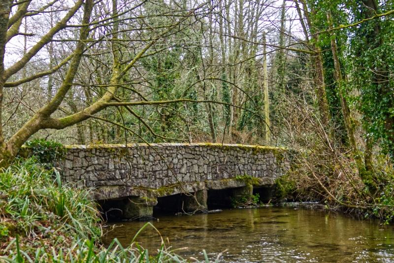
SW 73 NW STITHIANS KENNAL VALE
2/261 Bridge immediately south of Kennal
- Vale Mill
GV II
Road bridge over River Kennal. Probably C18 with C20 parapets. 4-Span bridge of
post and lintel construction. Low granite monolithic supporting large roughly-hewn
granite lintels. The parapets above are built of C20 quarried random granite rabble.
Listing NGR: SW7457936995
External links are from the relevant listing authority and, where applicable, Wikidata. Wikidata IDs may be related buildings as well as this specific building. If you want to add or update a link, you will need to do so by editing the Wikidata entry.


Other nearby listed buildings
