Latitude: 50.3323 / 50°19'56"N
Longitude: -4.2026 / 4°12'9"W
OS Eastings: 243335
OS Northings: 50365
OS Grid: SX433503
Mapcode National: GBR NT.XDC9
Mapcode Global: FRA 2825.4JZ
Plus Code: 9C2Q8QJW+WX
Entry Name: Cawsand Battery
Listing Date: 26 January 1987
Grade: II
Source: Historic England
Source ID: 1329146
English Heritage Legacy ID: 61887
ID on this website: 101329146
Location: Cawsand, Cornwall, PL10
County: Cornwall
Civil Parish: Maker-with-Rame
Built-Up Area: Kingsand
Traditional County: Cornwall
Lieutenancy Area (Ceremonial County): Cornwall
Church of England Parish: Maker
Church of England Diocese: Truro
Tagged with: Architectural structure Artillery battery
SX 45 SW MAKER-WITH-RAME NEW ROAD, Cawsand
9/231 Cawsand Battery
GV II
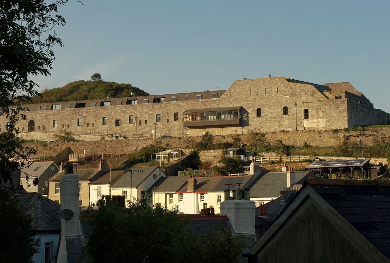
Fort. Dated 1867 on foundation stone to north east, built over 2 years and with later additions. Coursed limestone rubble with limestone copings to parapets. Situated on a spur with steep sides, cut off on the landward side by a moat, the fort is roughly triangular in plan, with barrack blocks along the south front to New Road, a curtain wall with ravelin to the landward (western) side, with gun emplacements on the north east(seaward) side. On the southern side, the barrack block is 2-storey to the outside, single storey inside. To the outside are 3 sets of 3 windows, formerly sashes, with door and paired loops. C20 raised walkway to upper ground floor level, parapet ramped up to end right with 6 loops at upper level, 2 segmental-headed lights at first floor and door to right and left. The barrack blocks were not furnished with bomb-proof roofs as they were supposedly in "dead ground" from fire. Curtain walls along seaward side, perforated by loops at regular intervals, of unusual form for firing horizontally and at an angle of 45 degrees downwards. On the inner side are 2 gun emplacements, with semicircular pivot tracks and magazine between them. Within the fort, between the north and south sides, a splayed limestone tunnel with segmental-headed door to vaulted chamber to one side. On the landward side, the curtain wall has a fire-step and loops, rising up the spur and culminating in a looped ravelin on the summit. The north east side of the fort was formerly entered through an archway which has now gone. The interior of the fort is honeycombed with an extensive tunnel system. The Battery is 130 feet above high water mark. The aim was to prevent a landing in Cawsand Bay, and was armed with 6 pounders as well as 7 inch and 8 inch breech loading rifled guns. These guns were considered powerful enough to assist Picklecombe Fort (q.v.) should the enemy invade the sound. The cost was £16,171. It is said that the guns were only fired once, causing houses in Cawsand village to fall down. Ancient Monument No. 911. Sources: Rawlings, K.: Defence Works Plymouth Area 1300-1983. 1984).
Listing NGR: SX4333750358
External links are from the relevant listing authority and, where applicable, Wikidata. Wikidata IDs may be related buildings as well as this specific building. If you want to add or update a link, you will need to do so by editing the Wikidata entry.


Other nearby listed buildings