Approximate Location Map
Large Map »
Latitude: 54.6244 / 54°37'27"N
Longitude: -1.3033 / 1°18'11"W
OS Eastings: 445080
OS Northings: 525698
OS Grid: NZ450256
Mapcode National: GBR MGBZ.M1
Mapcode Global: WHD6R.Y1K5
Plus Code: 9C6WJMFW+QM
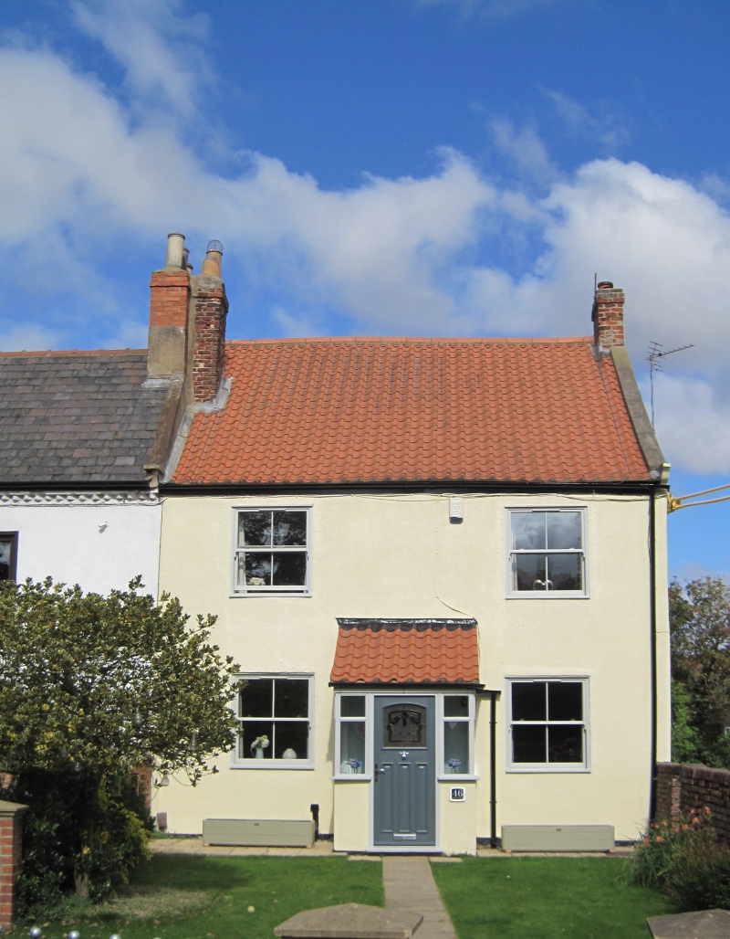
Entry Name: 46, Durham Road
Listing Date: 21 June 1985
Grade: II
Source: Historic England
Source ID: 1329466
English Heritage Legacy ID: 59528
ID on this website: 101329466
Location: Wolviston, Stockton-on-Tees, North Yorkshire, TS22
County: Stockton-on-Tees
Civil Parish: Wolviston
Built-Up Area: Wolviston
Traditional County: Durham
Lieutenancy Area (Ceremonial County): County Durham
Church of England Parish: Billingham
Church of England Diocese: Durham
Tagged with: Building
NZ 4525 WOLVISTON DURHAM ROAD
(North side)
18/437
No 46
GV II
Late C17 or early C18 altered. Two-storey, two-window front, now rendered*
Slated roof, probably raised, with end chimneys. Modern plate glass windows and
glazed porch. Included partly for group value.
Listing NGR: NZ4508025698
External links are from the relevant listing authority and, where applicable, Wikidata. Wikidata IDs may be related buildings as well as this specific building. If you want to add or update a link, you will need to do so by editing the Wikidata entry.


Other nearby listed buildings
